

TEXAS, USA —
Sunday, May 22, 2022
3:30 a.m. - Washington County is currently in the path of these storms. A Severe Thunderstorm is expected to impact Southeastern Washington County until 3:45 a.m.
All other watches and warnings at this time have expired, according to the National Weather Service.
1:00 a.m. - The following counties are under a Severe Thunderstorm Watch until 4 a.m.:
- Burleson
- Washington
Southwestern Robertson County is under a FLASH FLOOD WARNING until 3:45 a.m. The thunderstorms are bringing heavy rain across the northern part of the Brazos Valley, especially along and north of the Highway 79 corridor between Cameron to Hearne to Franklin.
The National Weather Service said the Little Brazos River is high water flow. TURN AROUND, DON'T DROWN. Don't try to drive on flooded roads, especially at night when it is harder to see what the danger is.
Saturday, May 21, 2022
10:53 p.m. - The National Weather Service has issued a Severe Thunderstorm Watch for the following counties until 4 a.m.:
- Burleson
- Washington
10:15 p.m. - The warning for Leon County has expired and a Severe Thunderstorm Watch remains in effect until 11 p.m.
9 p.m. - A SEVERE THUNDERSTORM WARNING has been issued for Northeastern Leon County. The storms were located along a line extending from Eureka to Fairfield to Buffalo, moving east at 45mph. The National Weather Service said there have been 65 mph wind gusts and nickel sized hail associated with this storm.
This WARNING will be in effect until 10:15p.m.
8:35 p.m. - A cluster of storms just north of Robertson and Leon Counties is moving east. At this time, there is no threat to the Brazos Valley. Storms may still form along the front when it arrives in a couple of hours. There could be some strong winds associated with these storms. Otherwise, just good old summer thunderstorms.
8:00 p.m.- This storm system has produced a severe thunderstorm warning capable of producing 60mph wind gusts and quarter-sized hail. The National Weather Service said damage to vehicles is expected and wind could damage roofs, siding and trees.
6:30 p.m. - Several central Texas counties remain under a Severe Thunderstorm Watch as the storm system continues to move east.
5:55 p.m. - A line of storms are moving in west of the Brazos Valley, some are showing severe potential. The storms are expected to be in the area between 8 p.m. - 10 p.m. tonight. These storms could break apart before they reach the majority of the Brazos Valley.
However, if this line does reach the area, we could be in for a noisy night. There is a lot of thunder and lightning that have been associated with these storms, as well as a lot of gusty wind. Be prepared for severe weather!
3:45 p.m. - The National Weather Service has issued a SEVERE THUNDERSTORM WATCH for the following counties in the Brazos Valley:
- Leon
- Robertson
The watch is expected to last until 11 p.m. Saturday at this time.
To get the latest sent to your phone here are the keywords you need to know:
- Text FORECAST to 979-703-8404 and get the latest weather forecast
- Text RADAR to 979-703-8404 and get linked to our LIVE radar
- Text APP to 979-703-8404 and get a link to download our app
What is the difference between a WATCH and a WARNING?

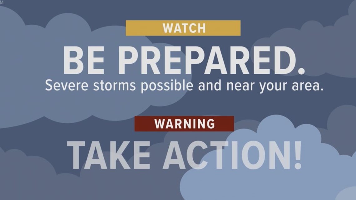
If an agency issues a storm WATCH, it means you should get prepared. Storms are possible or are on their way to your area. Get informed. Get your safety kit together, and prepare your pets.
If an agency issues a WARNING, take action! Warnings are issued when dangerous weather is in the area and could be life threatening. Don't go outside to watch or record dangerous weather. get to safety. While we love having you send us photos and videos, we want you to be safe. Leave mobile homes that can blow over in high winds. Warnings are not issued unless trained weather spotters/law enforcement officers who are trained to watch for weather get the information back to the National Weather Service.
Warnings mean changing weather can happen without any warning so keep on the look out!
Storm safety tips:
Severe Weather at Home
If you are at your home when severe weather hits, make sure you stay weather ready. Get to a secure location away from windows, especially if you are in a severe thunderstorm warning. Damaging wind and/or large hail can come quickly, as can other severe weather, especially tornadoes. Don't forget to bring those pets with you!
Severe Weather at School/Workplace
Stay away from windows and don't go into a large open room like a cafeteria, gym or auditorium.
If You're Outside
Find shelter immediately. Find a sturdy structure, something other than a shed or storage facility. Those are not safe. Do not seek shelter under a tree. Not only could a tree fall, it increases your chance of getting struck by lightning.
If You're in Your Car
Drive to the closest secure building and wait out the storm if there is enough time to get to safety. If you can't get to safety, park your car out of traffic and stay in your car with your seat belt on. Put your head down below the windows and cover your head with your hands, a blanket or a coat. ONLY leave your car if you can safely get noticeably lower than the level of the road.
How do I send in photos or videos?
If you have any photos or videos to send us, there are a couple of ways you can do it!
You can download our app and directly upload there! Just scroll down until you see this picture with "Be a part of our team".

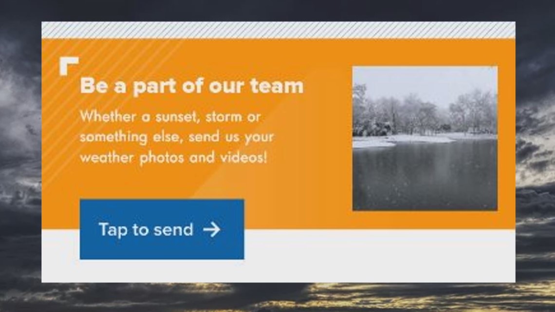
If you have a photo or a video, you can simply text us at 979-703-8404.
It will come directly to us. If the video is too large, try sending it through the app above!