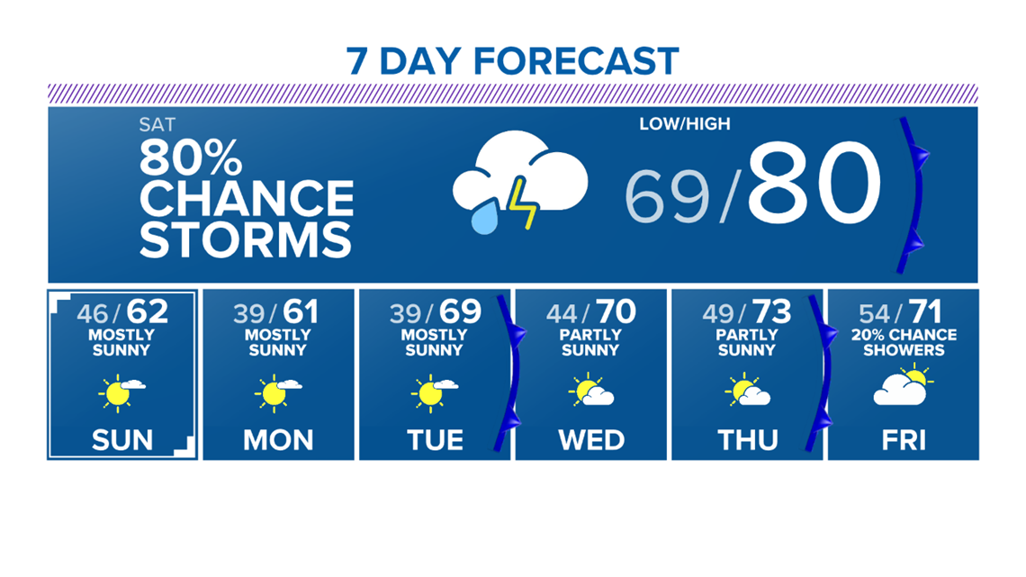
BRYAN, Texas — Warm & humid airmass will remain in place Friday night for the Brazos Valley. This will keep temperatures in the upper-60s & lower-70s for lows Saturday morning. Areas of spot showers & drizzle possible, too, overnight Friday into Saturday morning.

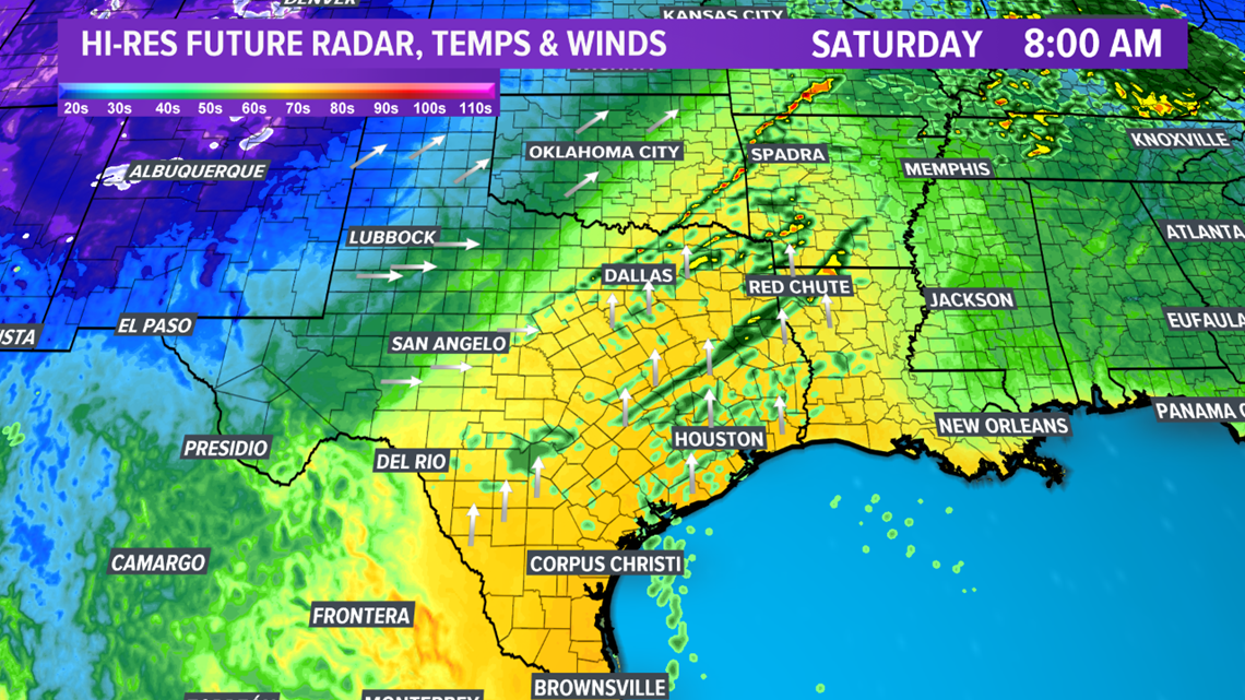
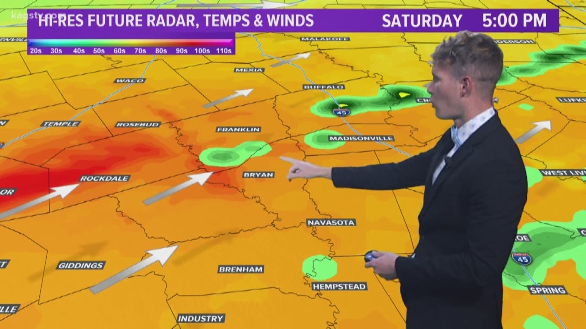
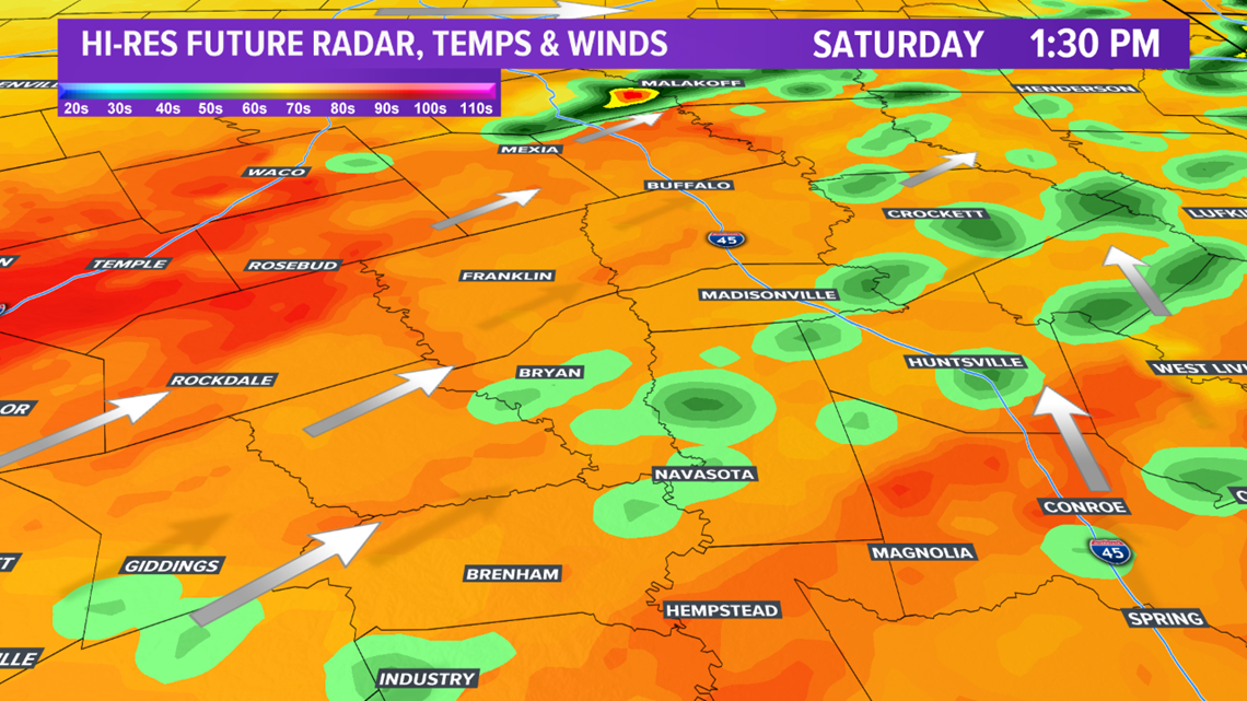
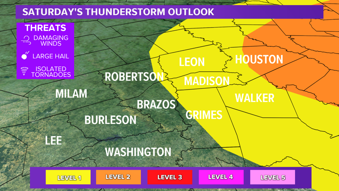
The warm & humid airmass will help setup the potential for strong to severe storms Saturday afternoon. A strong storm system will move into the Plains. This will send a cold front south into the Brazos Valley by Saturday afternoon. The cold front will create the lift required for thunderstorms to develop. The warm & humid air, as well as enough wind shear from the storm system to our north, will allow storms to become rather intense. The best wind shear will be to the northeast of the Brazos Valley but enough shear will be in place to support damaging winds. The large hail & tornado threat is low but not zero. Best tornado and large hail hazards exist closer to I-45.

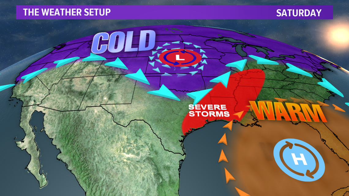


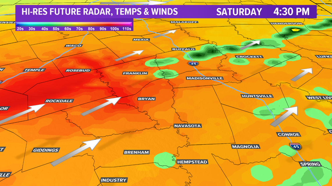

Once the cold front moves through Saturday afternoon, the severe threat will quickly diminish. Much cooler temperatures will filter into the Brazos Valley by Saturday night. Temperatures will remain in the 60s for highs with lows in the 30s & 40s for the next few days.