
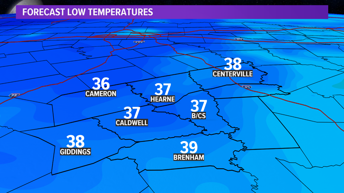
BRYAN, Texas — A high pressure over the region will lead to a chilly night once the sun sets. Temperatures Wednesday morning will start out in the 30s so a light jacket will be needed as you step out of the door. A frost is possible for the entire Brazos Valley with a few outlying areas falling to freezing.

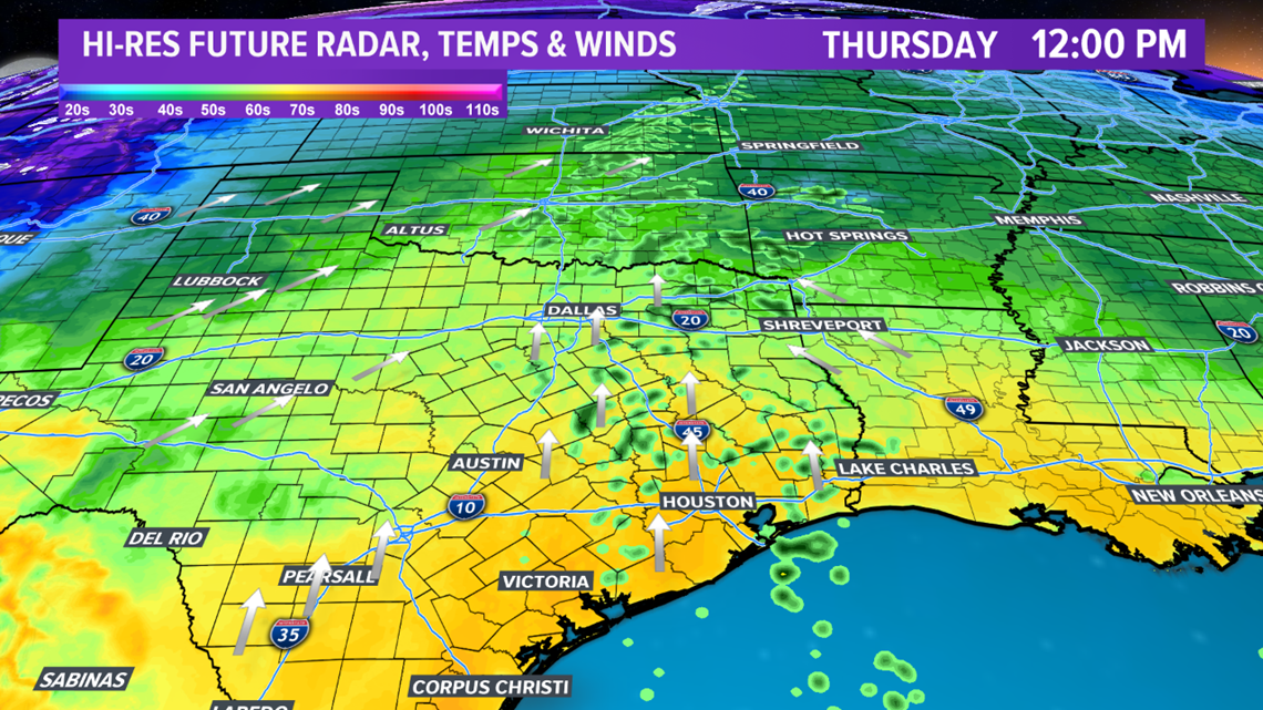
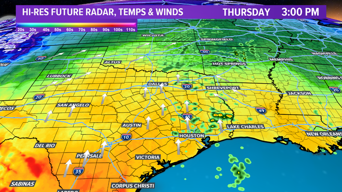
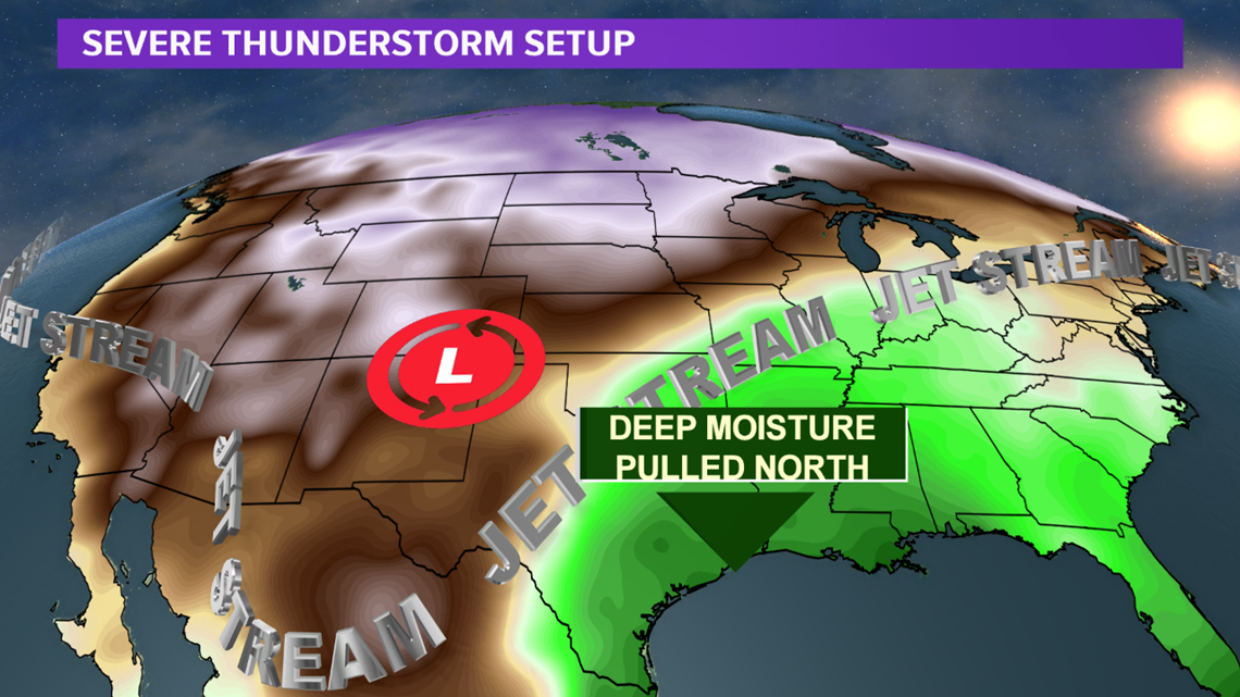
The surface high begins to shift east throughout Wednesday. This will allow Gulf moisture to advance north into the Brazos Valley throughout the day, continuing into Thursday. A few showers & storms possible Thursday as the moisture deepens across the area. Afternoon storms are expected to remain below severe levels. The increase in moisture will also coincide with a nice uptick in southerly winds on both Wednesday & Thursday. Winds will gust up to 30 mph.


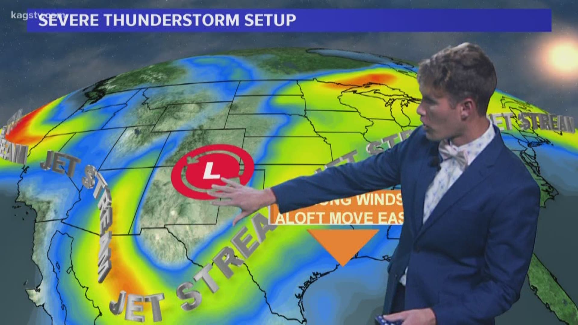
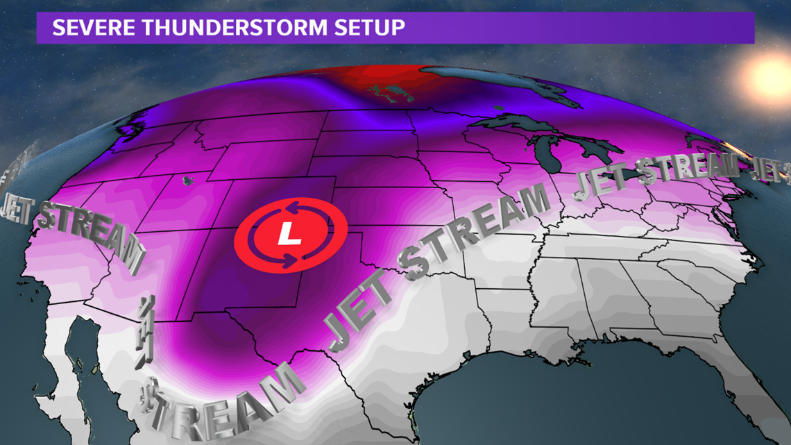
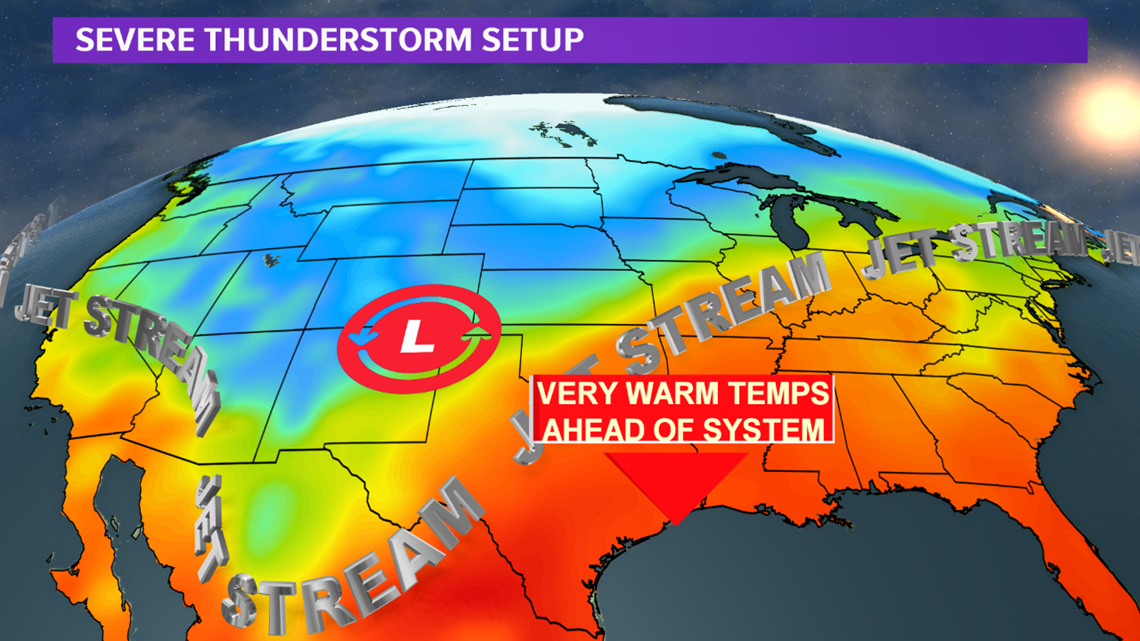
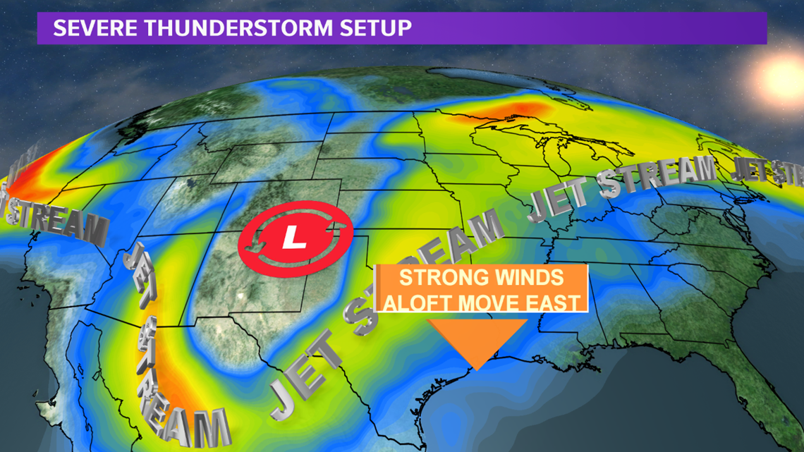
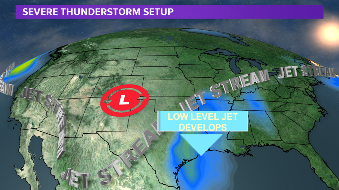
All eyes shift to Friday as the potential for a significant severe weather episode develops for much of eastern Texas, including the Brazos Valley. A large dip in the jet stream will continue to amplify and move into Texas late in the day on Friday. Out ahead of this dip in the jet stream will be very warm temperatures & deep Gulf moisture. These two variables will help feed and sustain thunderstorms once they develop. As the dip in the jet stream moves east, late Friday, it will spread strong upper-level winds over the Brazos Valley. At the same time, a low-level jet will establish over the region. This will allow storms to rotate and become severe.


The Brazos Valley is included in a Level 2 & Level 3 risk for severe thunderstorms Friday evening into the overnight hours Friday. This is a relatively high risk being a few days out from the event. It is possible a Level 4 risk may be needed as the event nears. It should be noted, however, if a few of the ingredients do not come together, the risk may be lowered.

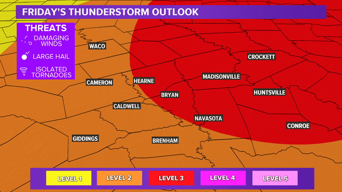
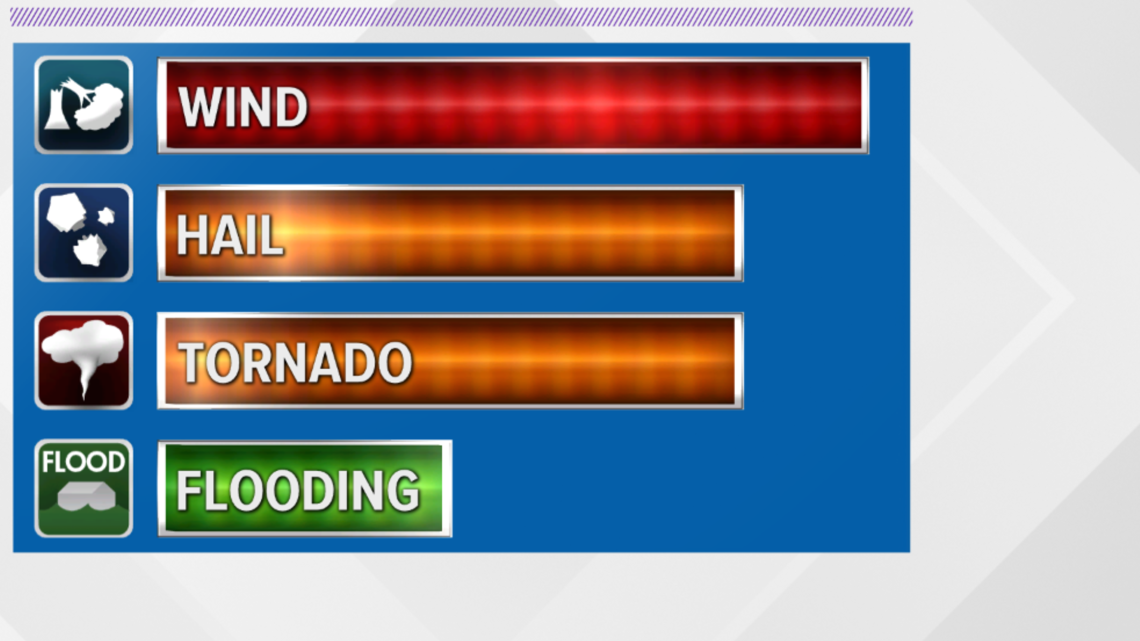
All modes of severe weather are possible, including: tornadoes, damaging winds & large hail. The timing is questionable at this time but the best time-frame will be late Friday evening.

Keep checking back for details as this is a fluid forecast that will require frequent updates.