BRYAN, Texas — Gulf moisture continues to feed into the Brazos Valley. This will keep overnight temperatures very mild overnight Thursday. When you head out of the door Friday morning, temperatures will be in the mid-60s. The moist airmass will allow for areas of low-clouds & drizzle Friday morning. Showers & isolated storms will continue through the morning hours into the early afternoon hours. Temperatures will climb into the mid-to-upper-70s by afternoon.


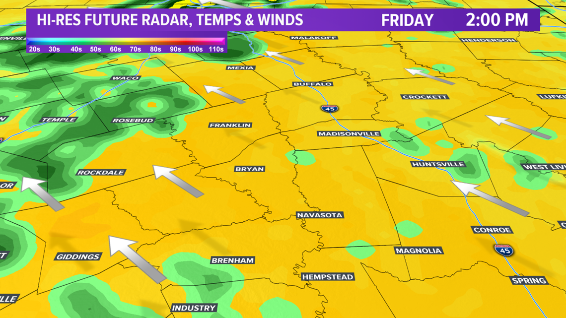
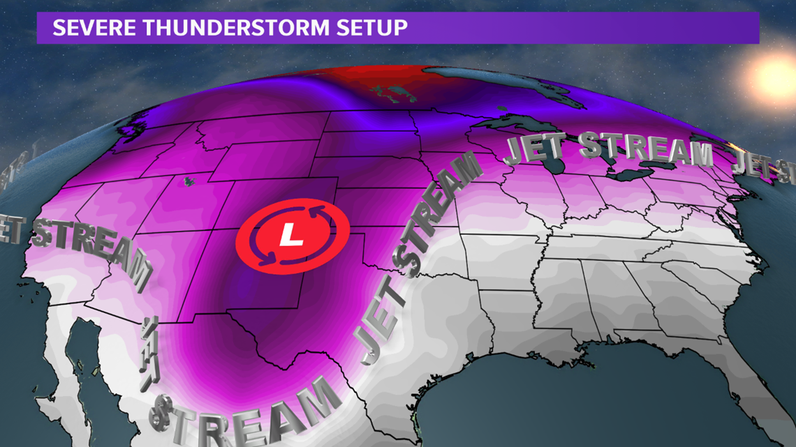
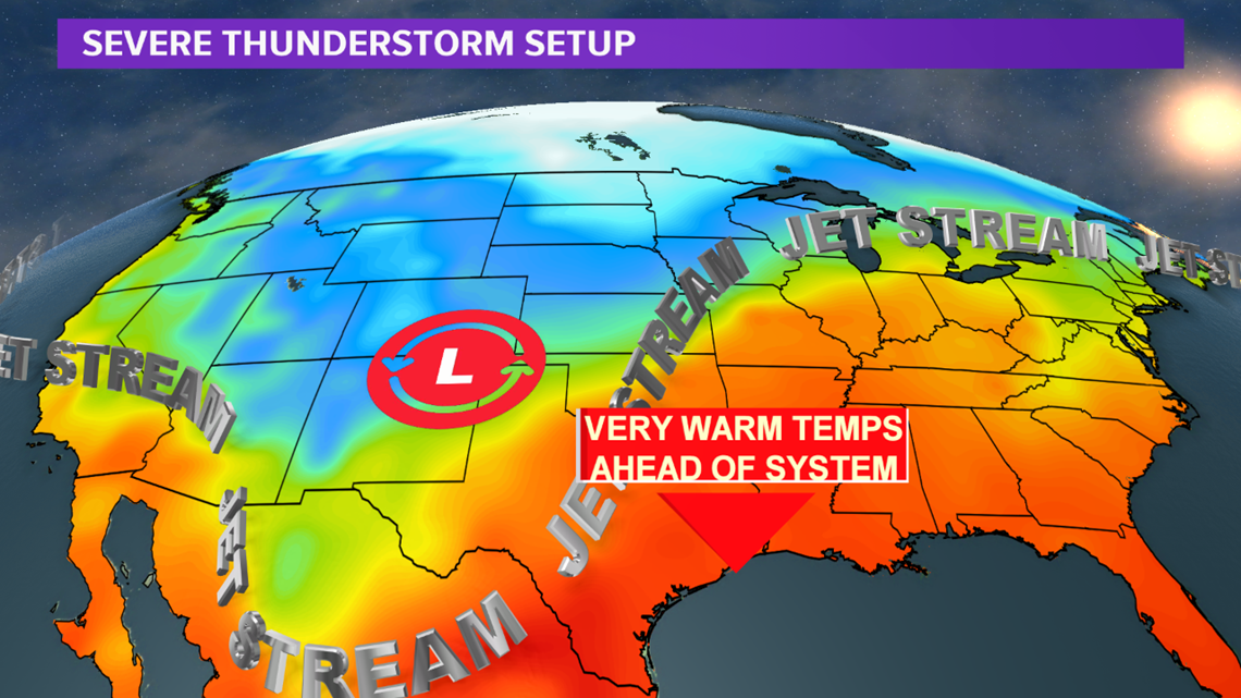
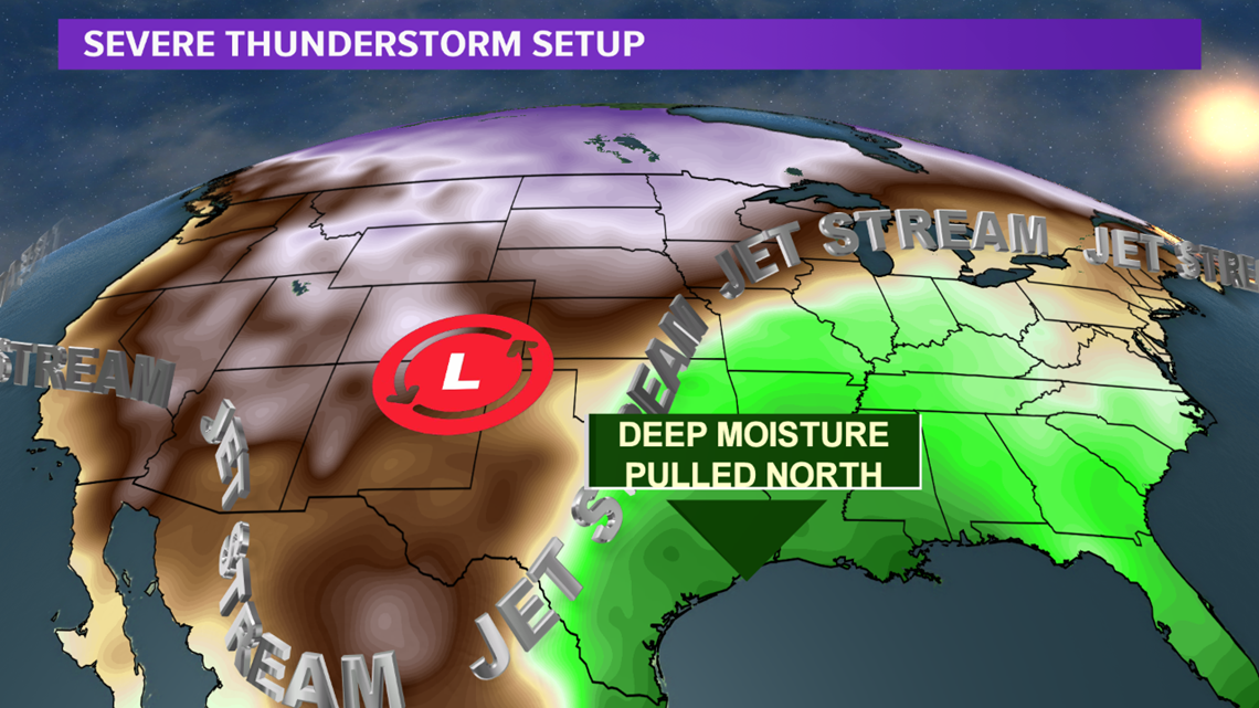
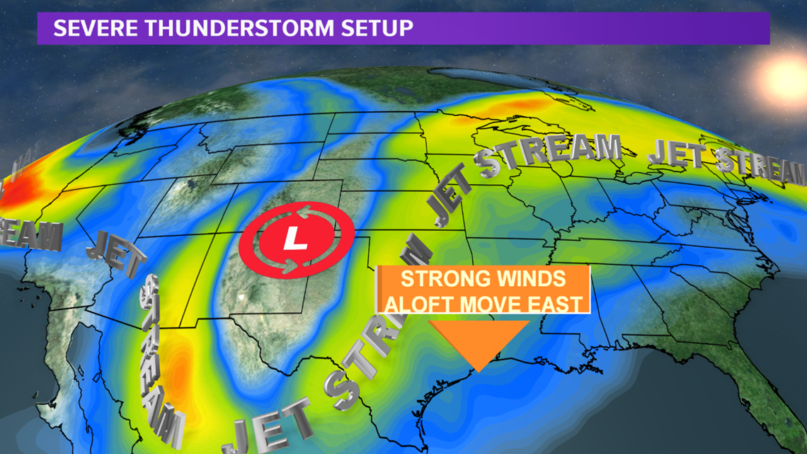
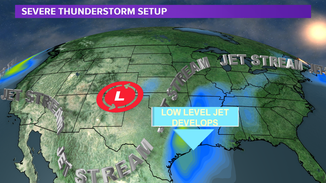
The main focus comes later in the day Friday as a powerful upper-level storm system digs into Texas. The warm & moist airmass ahead of this storm system is the energy needed to help feed severe thunderstorms later in the day. As this upper-level storm advances east throughout the day on Friday, it will spread strong upper-level winds over the Brazos Valley. At the same time these upper-level winds move overhead, a low-level jet will setup just above the surface. These ingredients (warm air, moist air, strong upper-level winds & a low-level jet) will set the stage for a severe weather episode across much of eastern Texas, including the Brazos Valley Friday afternoon into the evening hours.


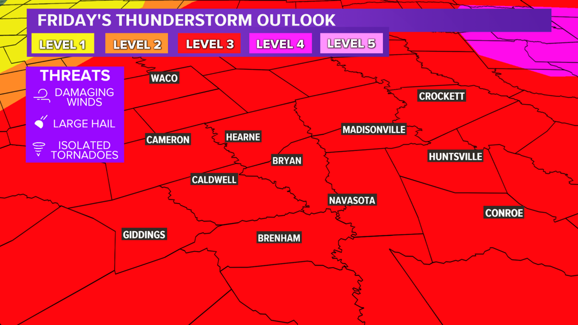
A Level 3 severe threat exists for the entire Brazos Valley. This means widespread severe thunderstorms are possible. A Level 4 exists just northeast of the Brazos Valley. It is possible this Level 4 may be extended southwest into the Brazos Valley.

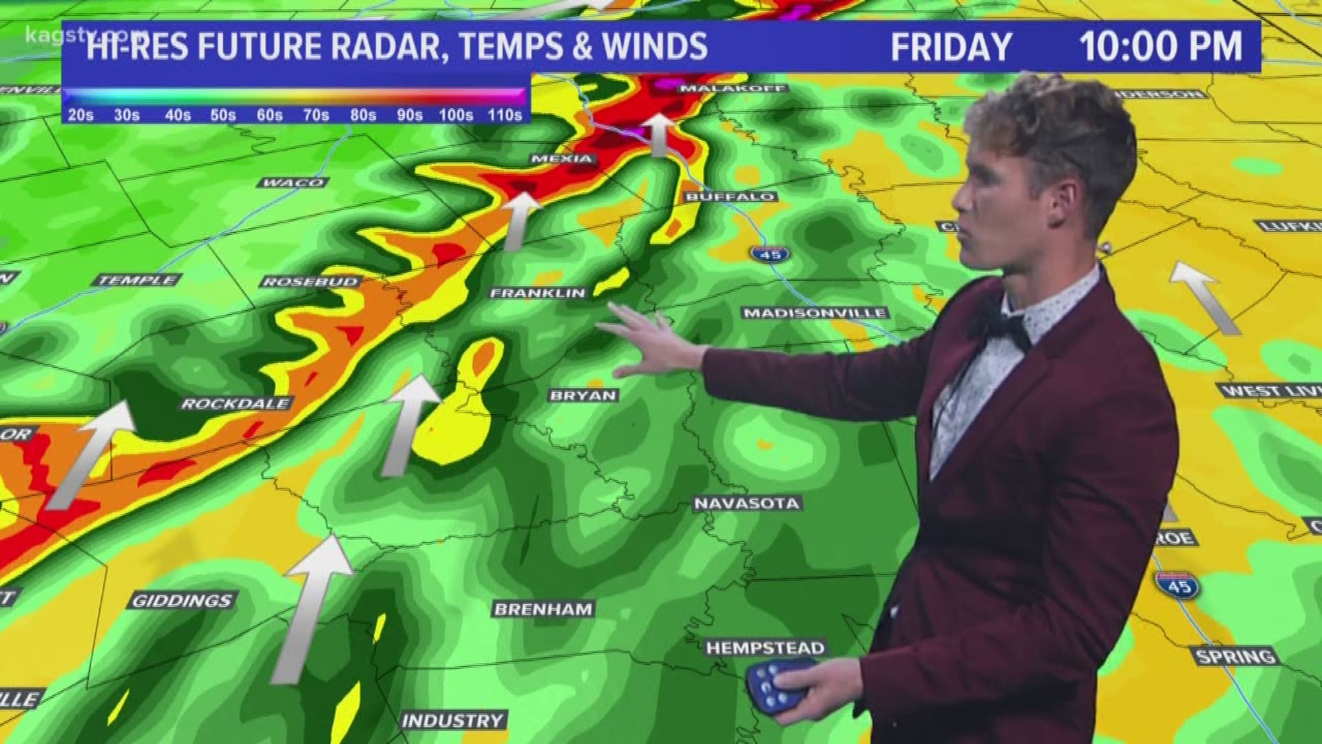
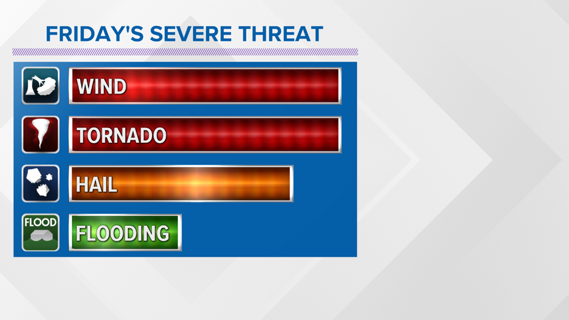
The mode of thunderstorms will vary. A solid line of severe thunderstorms will develop along I-35 Friday afternoon. Out ahead of this line of thunderstorms, isolated storms will develop and rapidly lift northeast. The storms ahead of the main line will have the possibility to produce tornadoes, large hail & damaging winds. An intense (EF-3 or stronger) tornado is not out of the question. The main line of storms will move from west to east Friday evening and pose an enhanced risk risk for damaging winds in excess of 80 mph, hail & isolated tornadoes.


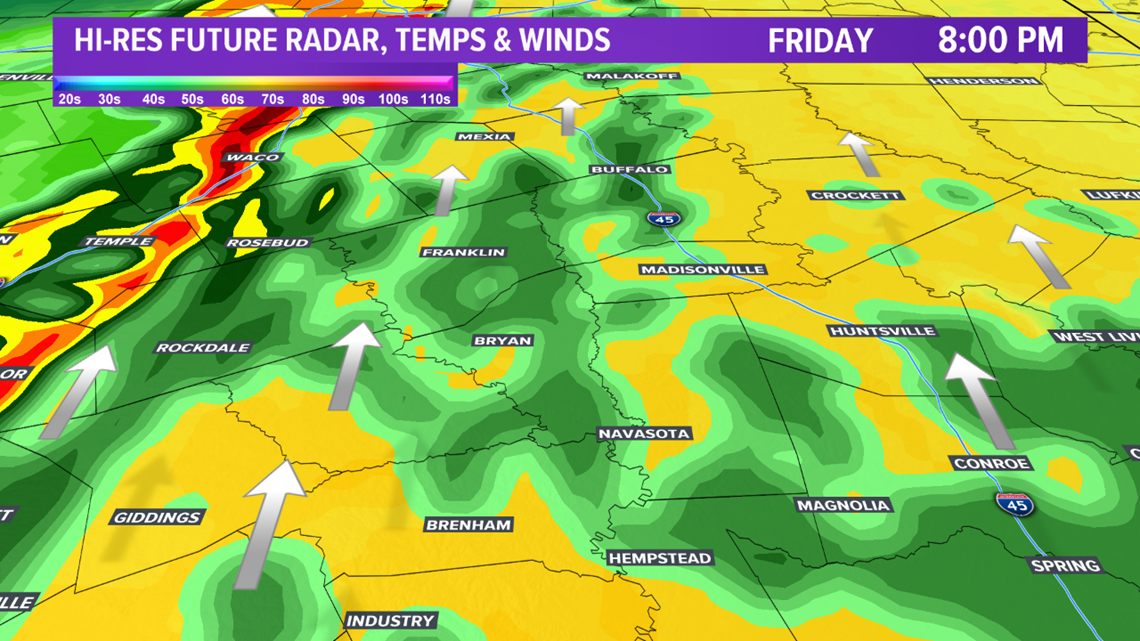

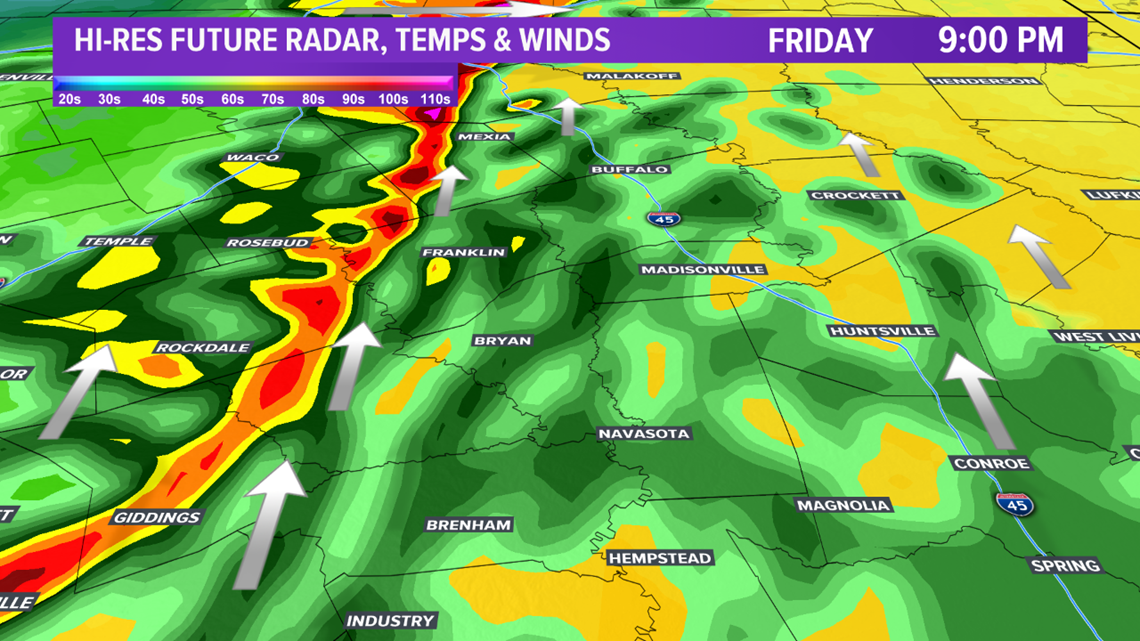

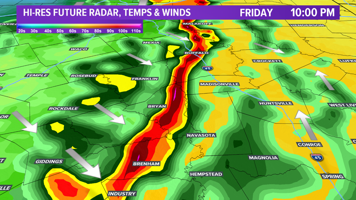

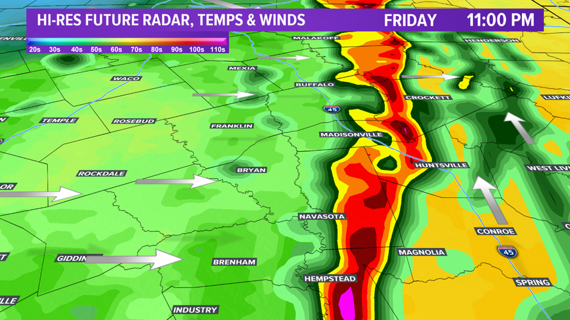

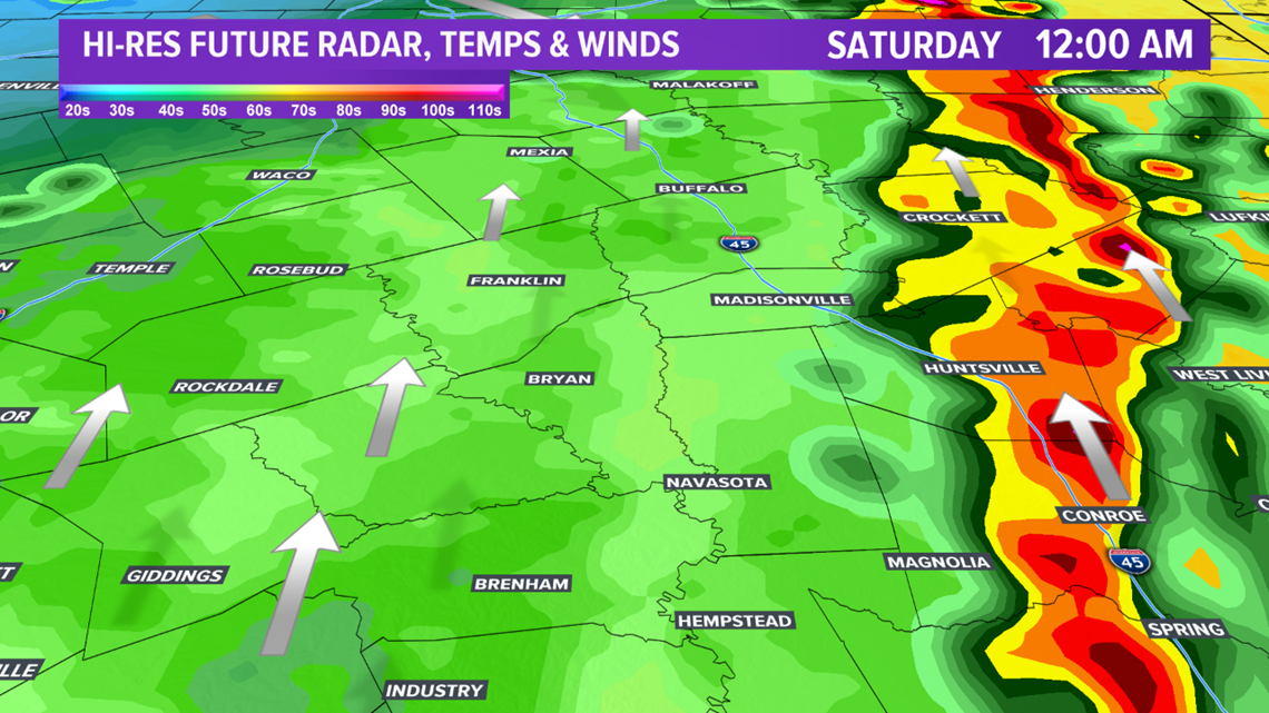
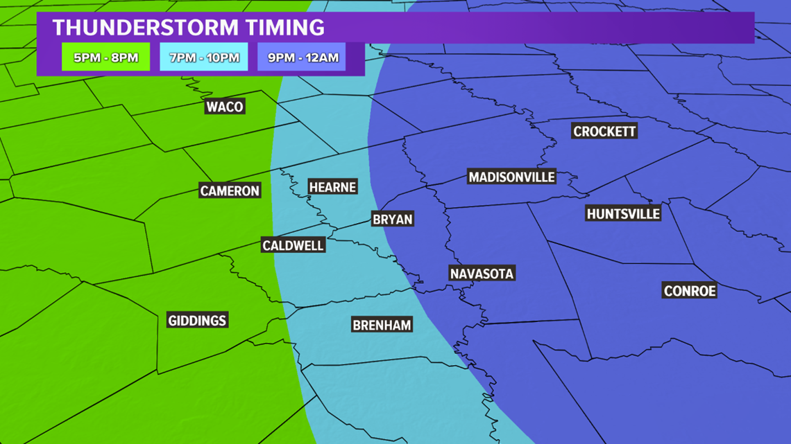
The severe thunderstorm timing will vary across the Brazos Valley. Thunderstorms will develop near the I-35 corridor around 5:00 pm to 7:00 pm Friday and gradually advance east into the heart of the Brazos Valley between 9:00 pm and 10:00 pm. Storms should move out of the area by 12:00 am Saturday.

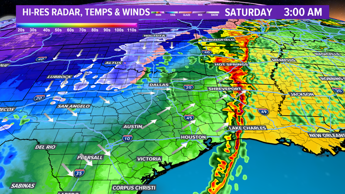
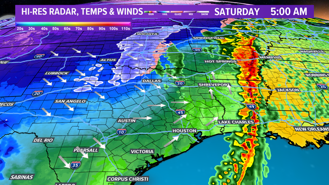
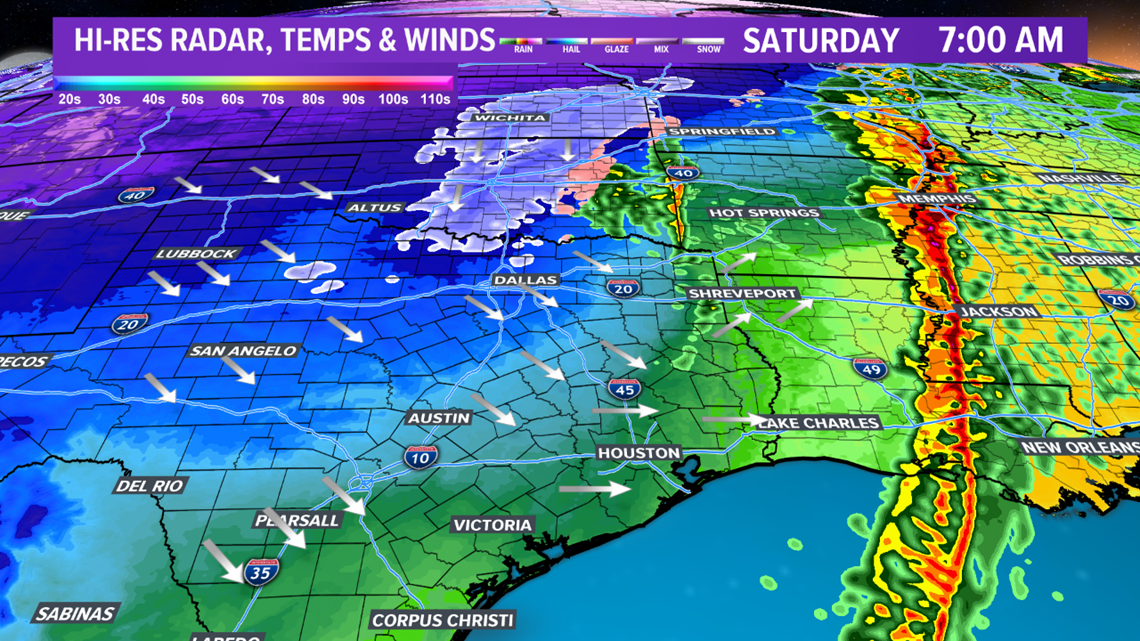
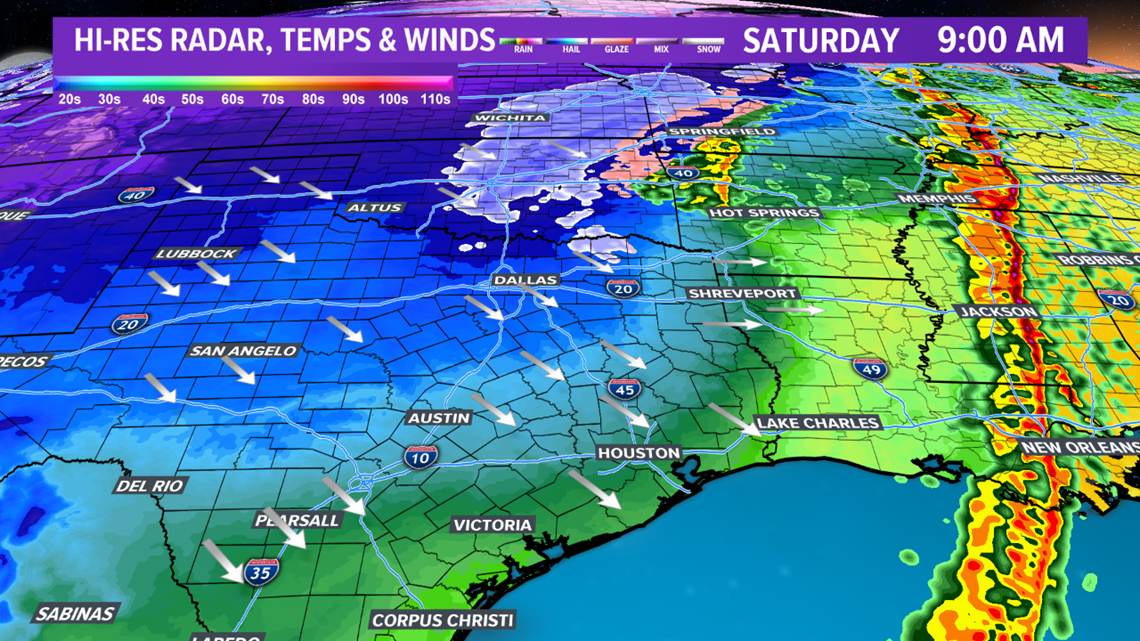
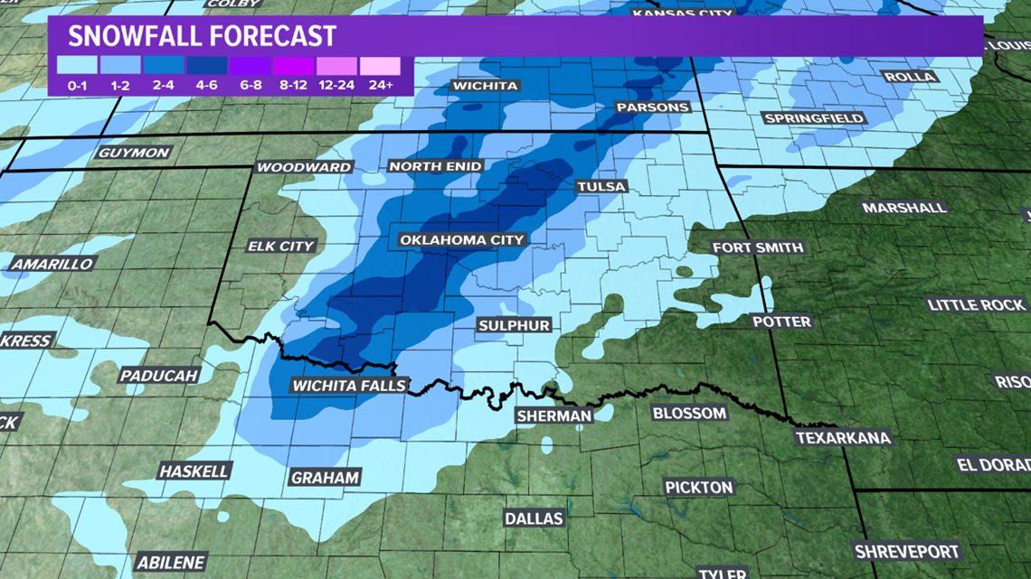
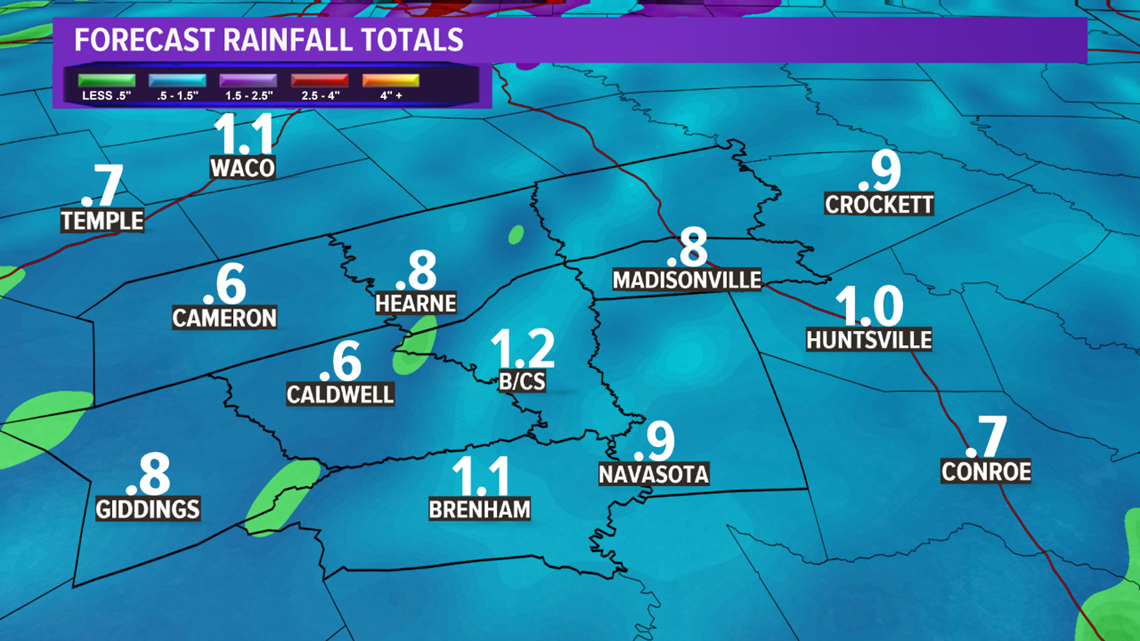
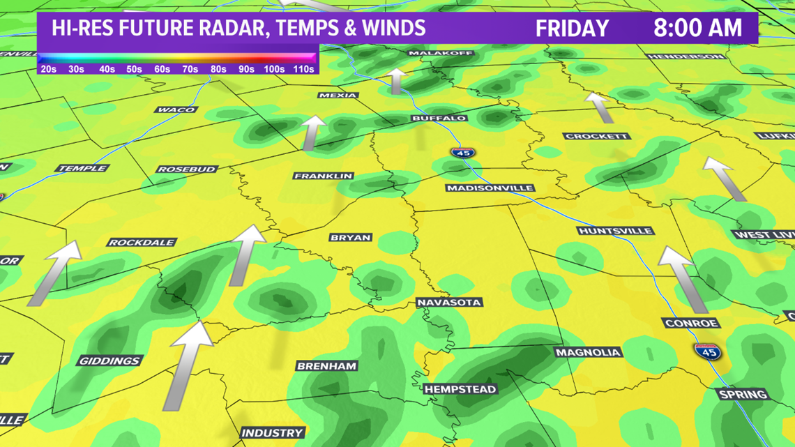
The dynamics with this system are impressive. After severe thunderstorms impact much of eastern Texas, snow will fall across northern Texas. The Dallas-Fort Worth Metro should see a wet rain/snow mixture Saturday morning. A coating of snow appears possible for northern parts of the DFW Metro. The Red River Counties of Texas may see 1-2" of snow. It is possible these snow totals may need to be adjusted up or down depending on the exact track of the system. While no snow is expected in the Brazos Valley, a good soaking of rain is in the forecast. About 1" of rain is in the forecast with isolated 2" amounts.