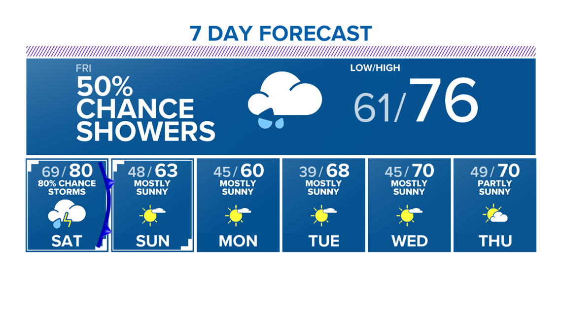
BRYAN, Texas — A warm front will lift north Thursday night, which will allow dewpoints & temperatures to rise overnight into Friday. Temperatures Friday morning will be in the 60s with areas of drizzle and spot showers.

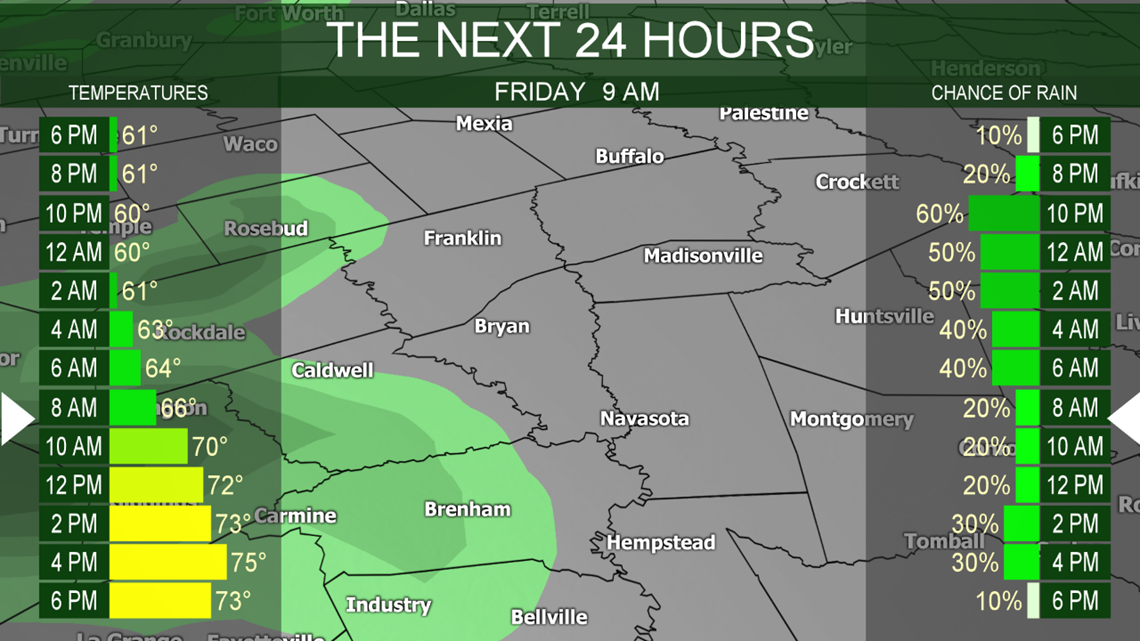
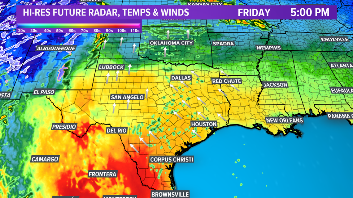
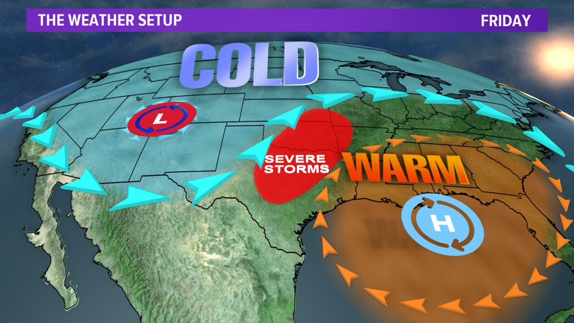
Temperatures Friday afternoon will warm into the mid to upper-70s thanks to the warm front. Spot showers will continue at times throughout Friday. A potent storm system will move into the four corners allowing the warm & most air to continue to stream into the Brazos Valley. The placement of this storm system paired with the moist & warm air will allow showers and storms to develop north of the Brazos Valley in northern Texas/southern Oklahoma. A few of these storms will be severe.


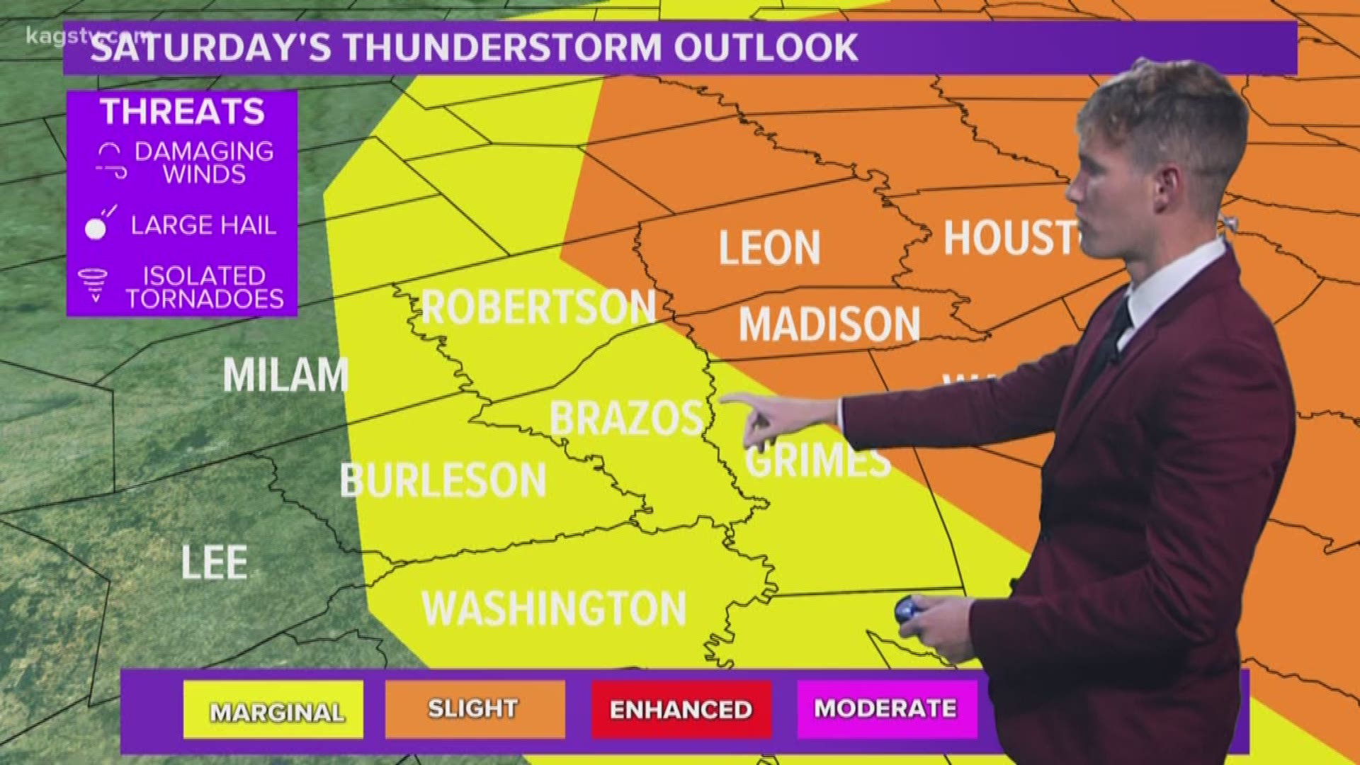
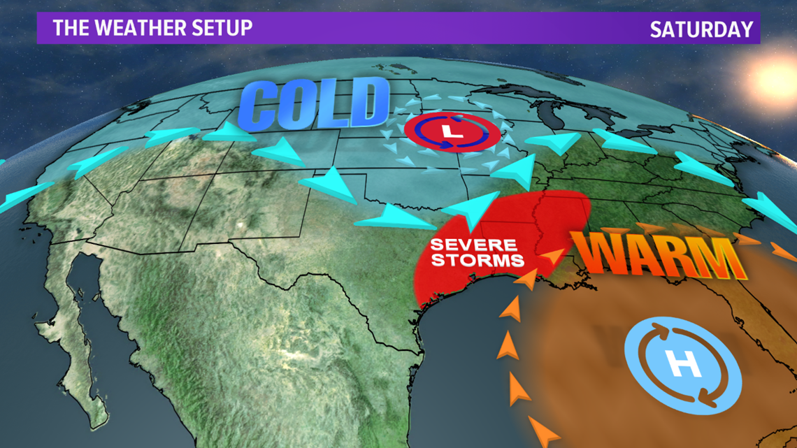
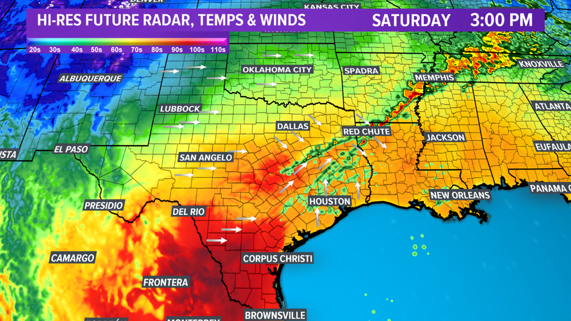
Heading into Saturday, the storm will move into the Plains, which will allow thunderstorms to develop along a cold front that will move into the Brazos Valley early Saturday afternoon. These storms have the possibility to become severe due to favorable wind-shear within the atmosphere and rich dewpoints in the 60s.


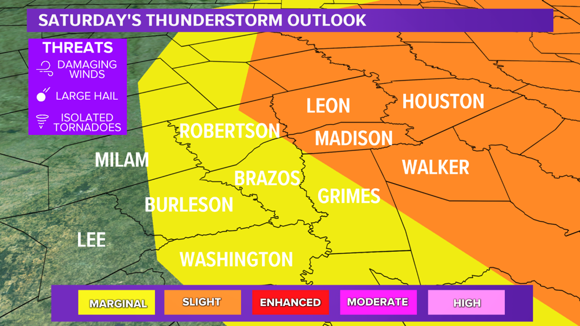
The main severe hazard is damaging wind but an isolated tornado and/or large hail cannot be completely ruled out. There is a marginal risk of severe storms for the western half of the Brazos Valley while the eastern half is included in a slight risk. KAGS will continue to provide updates on this evolving forecast.

Once the storms move through, temperatures will fall behind the cold front.