

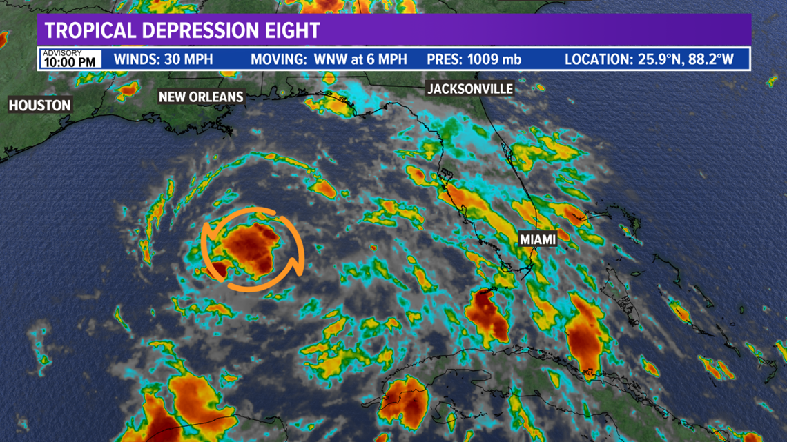
BRYAN, Texas — Tropical Depression Eight has developed in the Gulf of Mexico. The system has sustained winds of 30 mph and is moving towards the WNW at 6 mph.

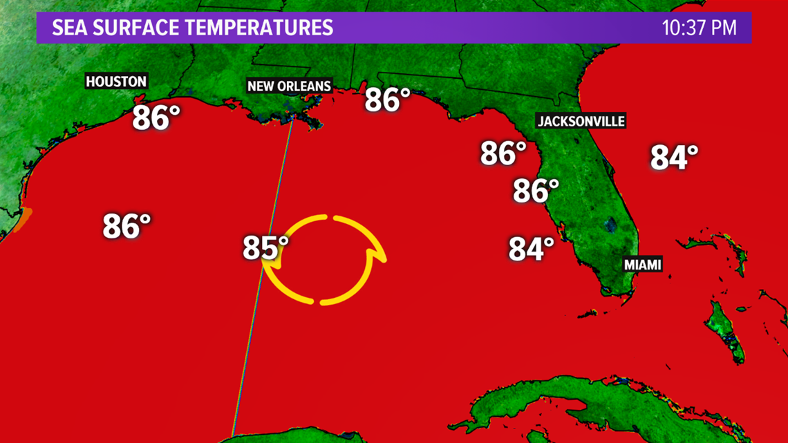
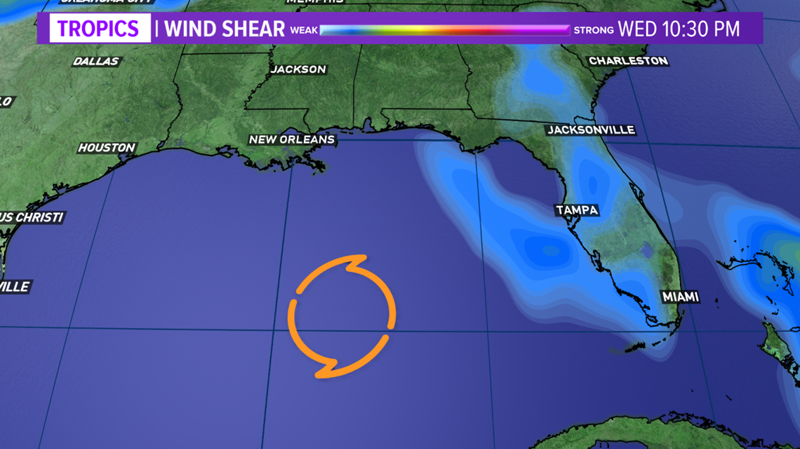
Tropical Depression Eight is expected to continue its WNW motion over the next 24-48 hours. As it continues on this path, it will encounter warm ocean waters and and light wind shear. These environmental conditions will allow TD8 to intensify into a Tropical Storm.


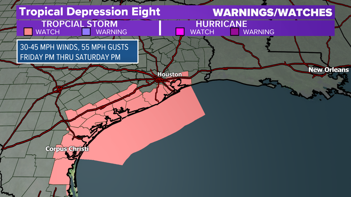
Landfall is expected late-Saturday as a Tropical Storm north of Corpus Christi. A Tropical Storm Watch is in place for a large part of the mid & upper-Texas coast. This Watch includes Galveston and Corpus Christi. These areas can expect Tropical Storm force winds late-Friday, continuing through Saturday. Winds will be sustained at 30 to 45 mph with gusts up to 55 mph.

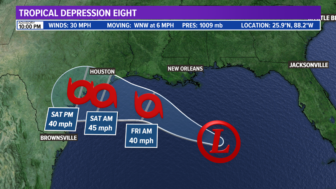

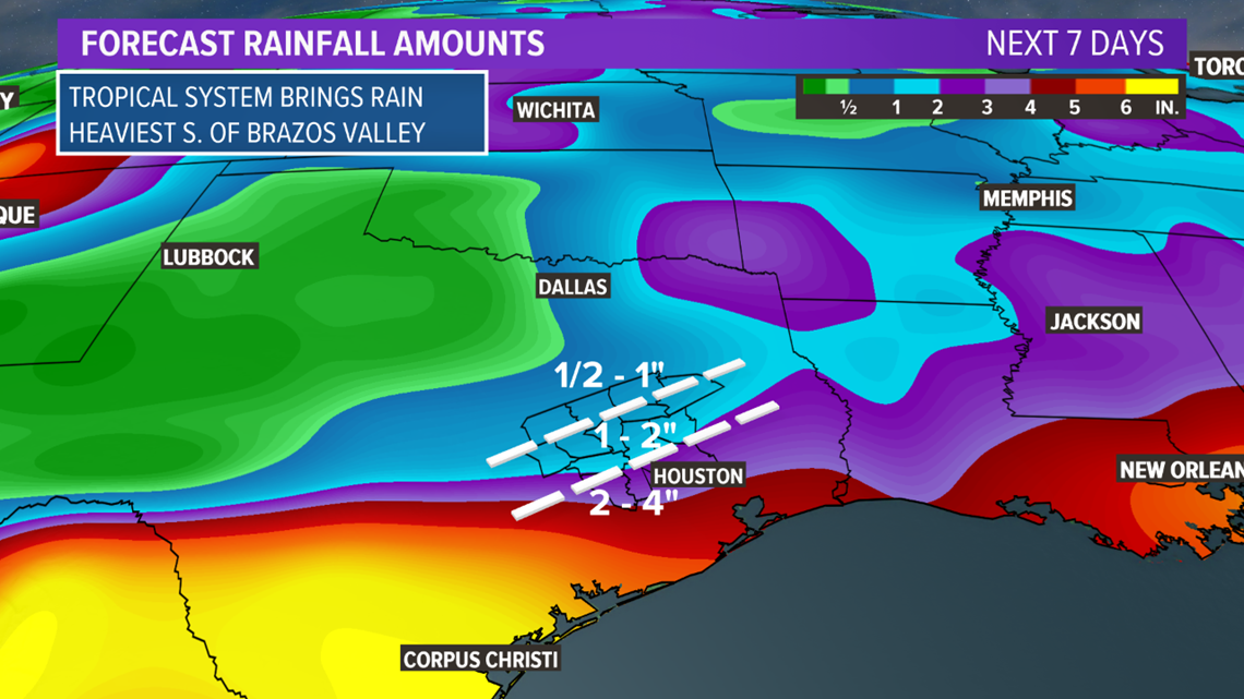
Heavy rain is the main hazard with this system as it slows down over the weekend. Parts of southern Texas may see several inches of rain, which may lead to flash flooding.

There is still uncertainty with Tropical Depression Eight. Anyone in or near the cone needs to remain vigilant and frequently check the forecast for updates; as significant forecast updates are likely.