
GRIMES COUNTY, Texas — Updated at 4:20pm to reflect latest information from GCSO.
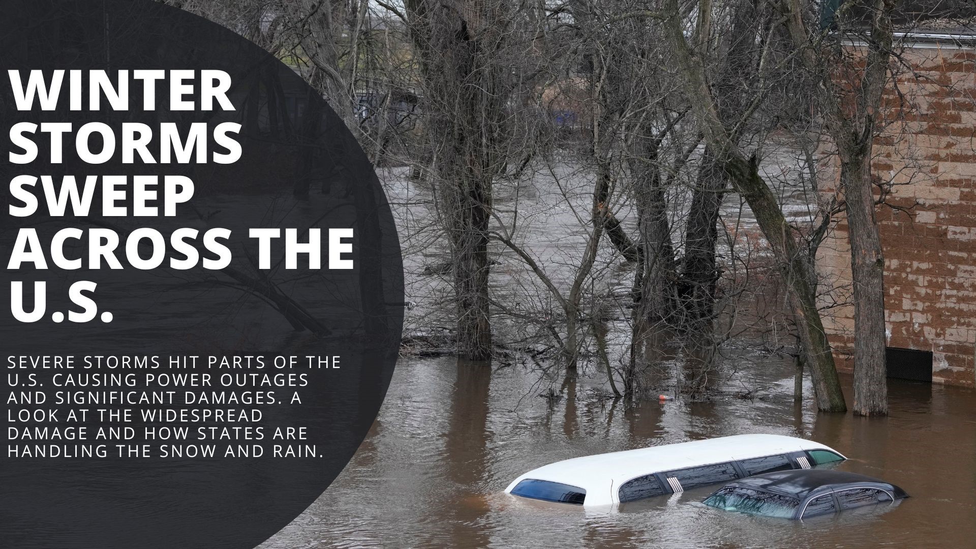
Several inches of rain have fallen across parts of the Brazos Valley since midnight Tuesday. According to the currently issued flood warning, some areas have seen over 13" of rain.
One of the hardest hit areas is Grimes County, where, as of 4:15 p.m. on Wednesday, sheriffs are reporting several road closures and instances of water on the roadways.
The affected roads, according to Grimes County Sheriff's Office are the following:
CLOSURES:
- Buff Lake at FM 1774
- CR 162 1 mile from CR 103
- CR 202
- CR 227
- CR 229
- CR 232
- CR 233
- CR 234
- CR 405
- FM 244 at Gibbons Creek
- FM 362 at Beason Creek
- FM 1486 near Casa Loma
- FM 3090 at Rocky Creek
Additionally, the following roads have water across the roadway:
- FM 2562 north of FM 149
- CR 180 near Rocky Creek
- CR 215 west of CR 211
- CR 215 just off FM 1774
- CR 216
- CR 219 west of CR 220
- CR 219 at FM 2562
- CR 238 near the 3000 block
- CR 446 between SH 105 and CR 410
Grimes County Sheriffs warn drivers not to attempt crossing flooded roadways. Water depth and strength of current can be deceiving and may lead to cars being swept off of roadways.
Anderson-Shiro CISD also announced in a tweet this morning that schools were closed and classes cancelled due to the severe flooding across the county.
WASHINGTON COUNTY IMPACTED
Another area in the Brazos Valley that is impacted by the heavy rain is Washington County.
The Washington County Office of Emergency Management, through its Facebook page earlier today, released the following list of the impacted roads:
• Gerke
• Dixie Rd
• Century Farms Rd
• N Meyersville Rd
• Janner Kuecker Ln
• Clay Creek Rd
• Jeske Rd
• Old Navasota Rd
• Terrace Rd
• River Bottom Ln
• Whiddon Rd
• Washington Cemetery Rd
• Lomax Harmel Rd
• Homeyer MTN Rd
• Salem Rd
• Rehburg Rd between Longpoint and 1948
• Copelyn Springs
• Lone Star Rd, Bridge
• Christian Cemetery Rd
• Engelbrecht Rd
• Ganske Rd
• Cocks Crow
• Basin Trl
• Williams Trl
• Firemans Park
• Hall Rd/ FM 109
• Sacred Heart Rd
• Pecan Glenn Rd
• Martin Luther King Jr PKWY / W Main St
• N Dixie St
• 2100 S Blue Bell Rd
• 900 N Berlin Rd
• 1500 N Berlin Rd
• FM 389 / Tigerpoint Rd – Water no longer over roadway but is right below bridge level – use caution
• Airport Rd / Old Independence Rd
• Old Independence Rd / to Bridge by Sheriff's Office
• Ellermann Rd
• Earlywine Rd
• 1306 Lange Lake Rd
• Randle Hill Rd from Shirttail Rd to Meier
• Dierking Rd
• Grote Rd
• Branch St (West and East)
• Apperson Rd (at the Creek)
• Old Masonic Rd
• 1500 Tommelson Creek Rd
• 8300 Old Independence Rd
• 3500 Mustang Rd
• Bredthauer Rd near FM 2780
• Kuykendall Rd near Rocky Creek
• FM 2935 near Tommelson Creek (near Reue Ln)
• Mayer Cemetery Rd (Still passable but water starting to pool on 1 side of road)
• 1155 S and Copelyn Springs Road
We will follow this story and update as the station receives more information.
Also on KAGS: