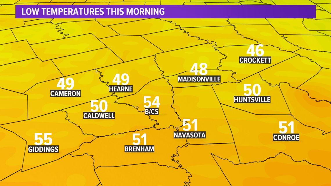
BRYAN, Texas — After a cool start this morning (lows in the 40s & low-50s) but temperatures warmed into the 60s & 70s this afternoon.
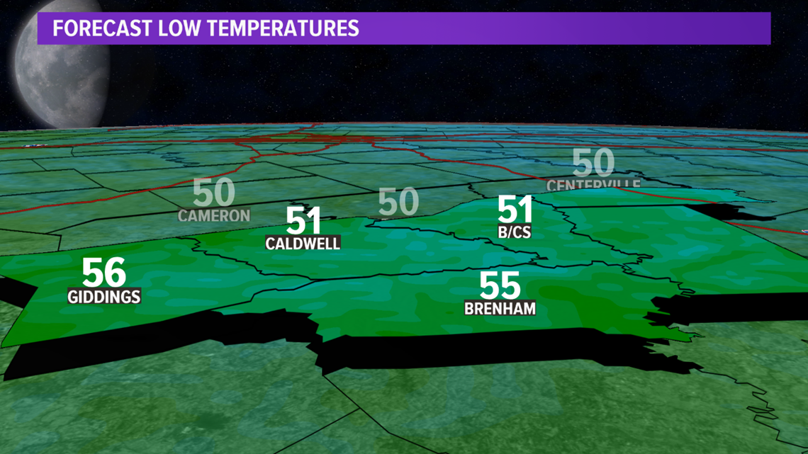
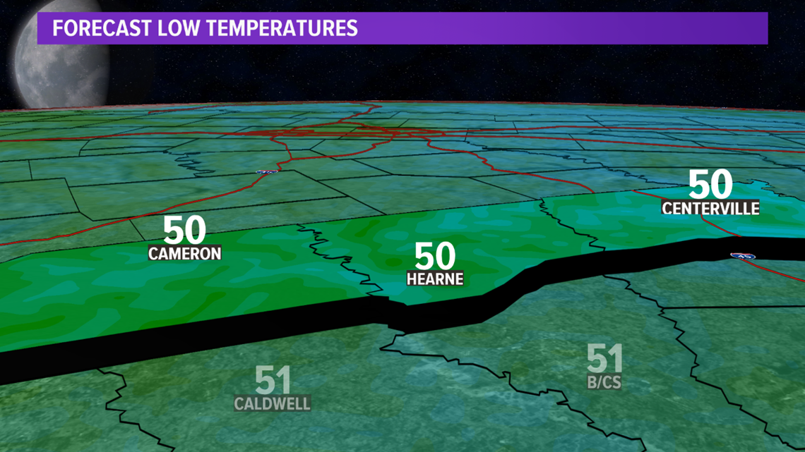
Another cool morning is in the forecast Friday with lows falling back into the upper-40s & lower-50s. A warming trend will take place Friday afternoon with highs finally getting back into the low-80s.
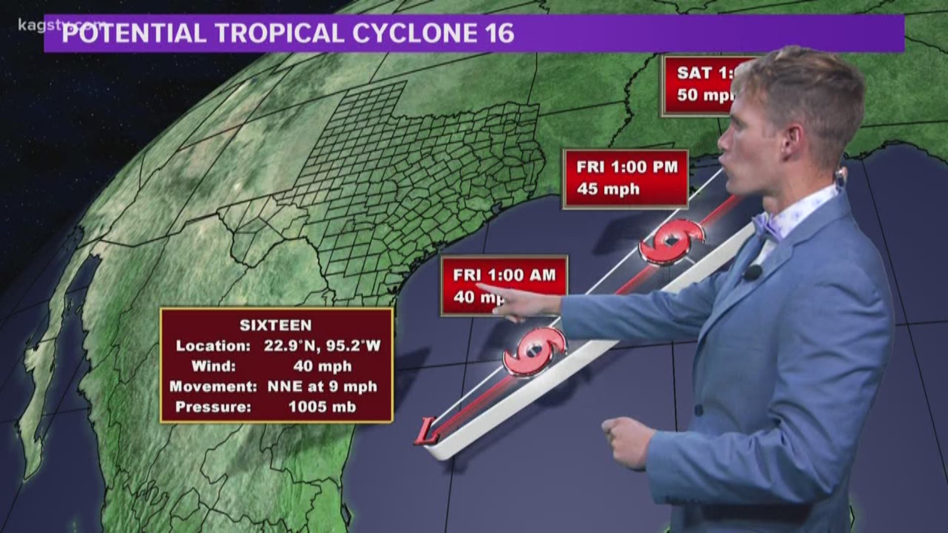
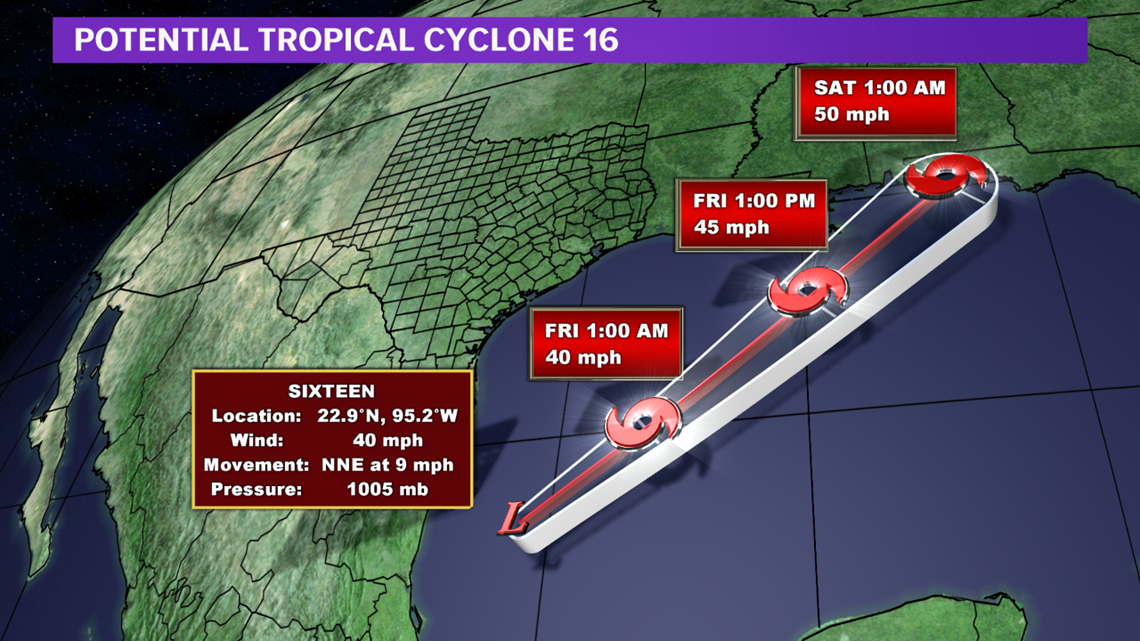
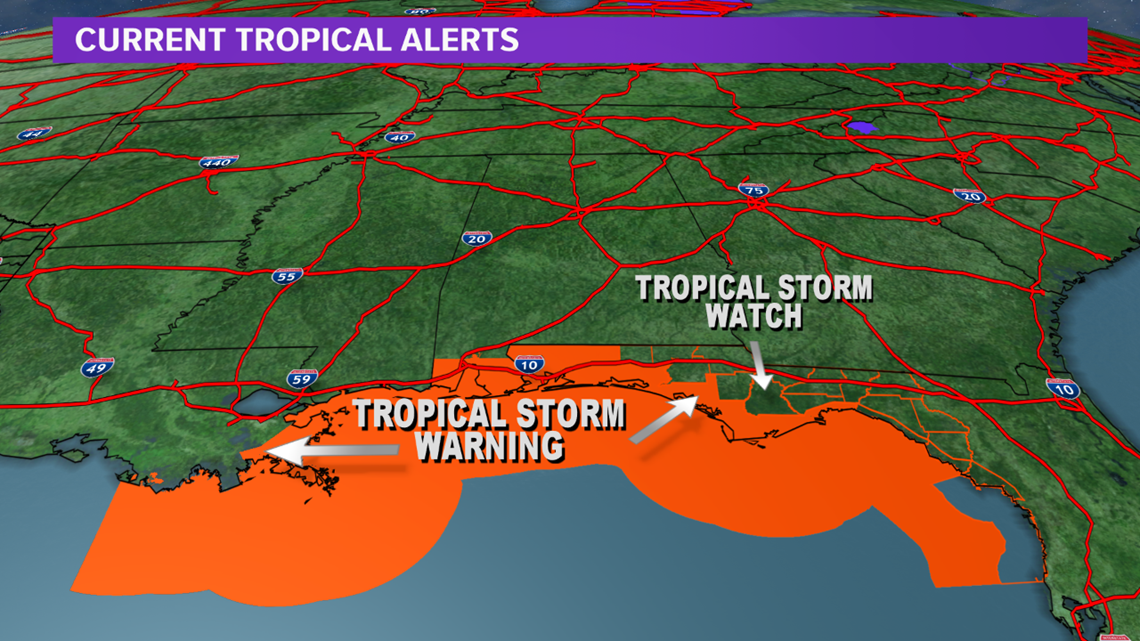
Of note, is a developing tropical cyclone in the Gulf of Mexico: Potential Tropical Cyclone 16. Tropical Storm Warnings have been issued for parts of the Gulf Coast. Luckily, an upper-level low over southern Texas will help steer the tropical cyclone northeast toward the Florida Panhandle and away from Texas.


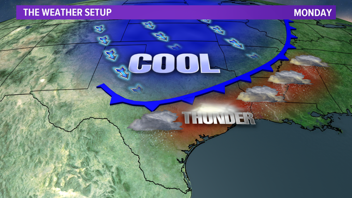
Over the weekend, a storm system to our west will help draw in warm & moist air into the Brazos Valley. This will allow highs to soar into the mid to upper-80s. This warm & moist airmass will help set the stage for strong to severe storms from northern Texas Sunday afternoon to the Brazos Valley by Monday. Behind the line of storms, which will be triggered by a cold front, will be cooler air. Temperatures will remain in the 70s for highs for much of next week with lows in the 40s & 50s.