BRYAN, Texas — Cold front moving south is ushering in colder air into the Brazos Valley. Temperatures Wednesday morning will start out in the 30s & 40s. Northerly winds of 15-20 mph will drop wind chills will be in the 20s & 30s so make sure you have a jacket as you head out the door. Precipitation chances begin to increase late-Wednesday morning as an upper-level disturbance crosses over the area. Temperatures will be above freezing with a stout layer of warm air at 5,000 feet above the surface, thus, rain is expected. It is possible a few sleets pellets or small hail may fall with the strongest updrafts.


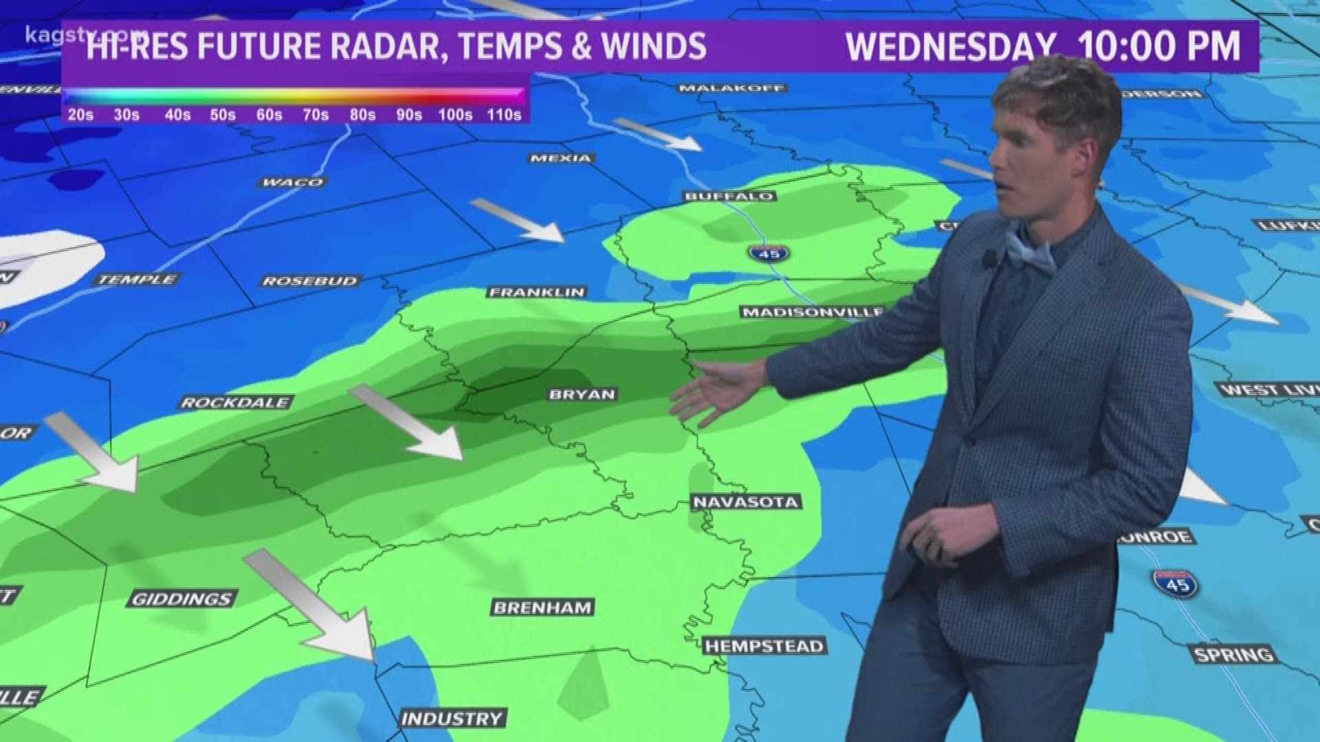
Precipitation chances slowly decrease Wednesday afternoon until the next upper-level disturbance moves through. This disturbance will create strong lift and will tap into some residual moisture hanging on across the Brazos Valley. Temperatures late-Wednesday will be significantly cooler throughout the entire atmosphere from the surface up to where the jets fly. This means any precipitation that falls will fall as sleet & snow. The best window for wintry weather will be from 10:00 pm Wednesday through 6:00 am Thursday. No widespread, major accumulations are expected at this time for the Brazos Valley. If convective elements occur within the precipitation, it is possible a few areas could see light accumulations. No travel issues are expected.


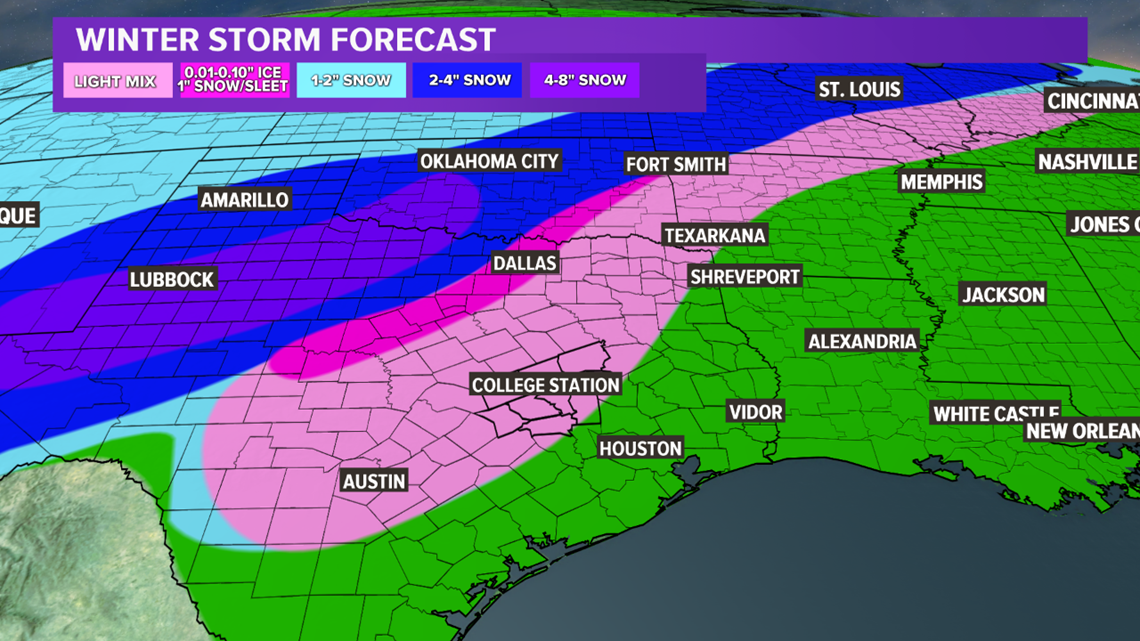
Farther north, the atmosphere is colder. This will lead to a full-fledged winter storm. Beginning Tuesday night into Wednesday morning, a wintry mixture of sleet and freezing rain will fall across far northern Texas. Farther north & west, into western Texas and Oklahoma, all snow is expected. The snow will continue for these areas on Wednesday and the sleet/freezing rain will transitions to snow late-morning for northern Texas.


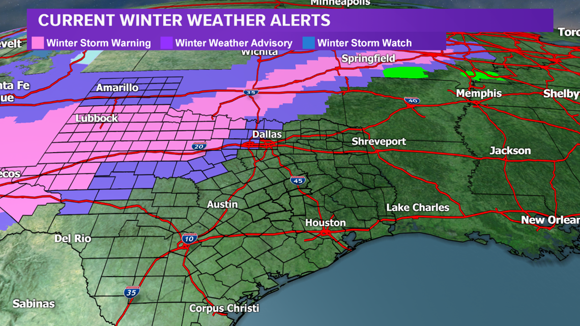
Significant accumulations from Tuesday night into Wednesday are expected north of the Brazos Valley that will lead to travel issues. Due to the expected travel issues, Winter Storm Watches & Advisories are in place for a large part of western & northern Texas, extending north into Oklahoma.