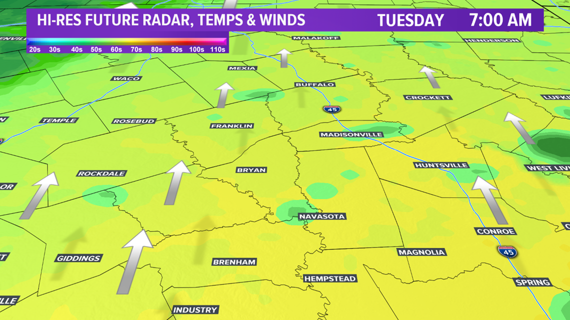
BRYAN, Texas — A few spot showers possible across the Brazos Valley Monday night as a weak upper-level disturbance moves across the area with increasing moisture. Tuesday morning will start out mild in the 60s as southerly winds continue the moisture transport.

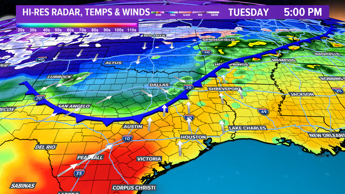
Temperatures will quickly warm into the 70s Tuesday afternoon across the Brazos Valley but lurking to the north will be a strong cold front. Northern Texas will have temperatures in the 40s by Tuesday afternoon with a strong northerly wind. The 40s will seep south into Brazos Valley late-afternoon/early evening. As the cold front moves through, a line of isolated storms may develop. The fast movement of the front appears it will undercut the updrafts, which will limit the severe potential. Farther east, across eastern Texas, a higher chance for one or two severe storms exists. Main hazards are large hail and damaging winds. The cold front should exit the entire area before midnight.


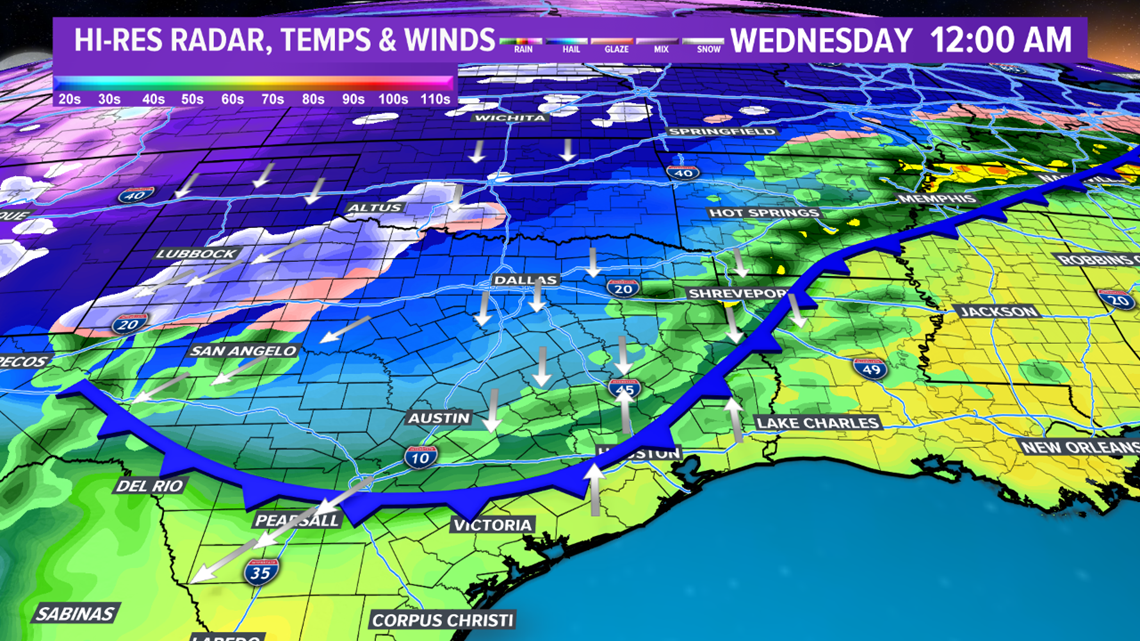
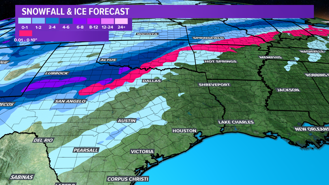
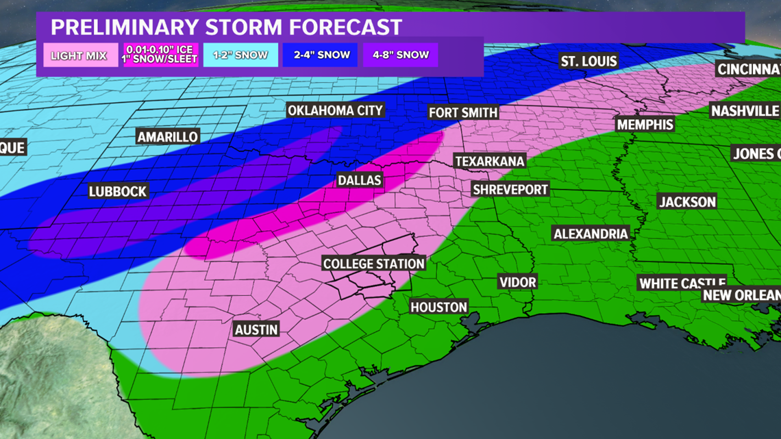
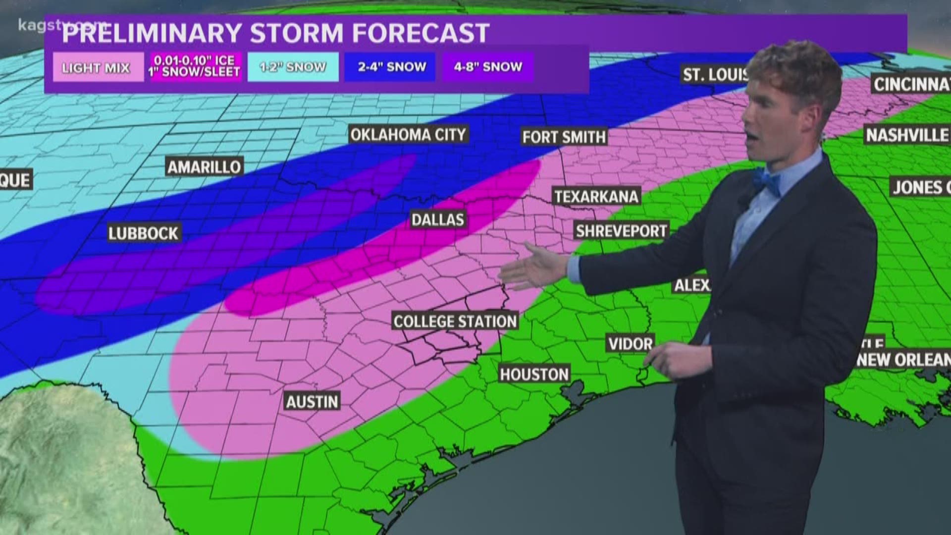
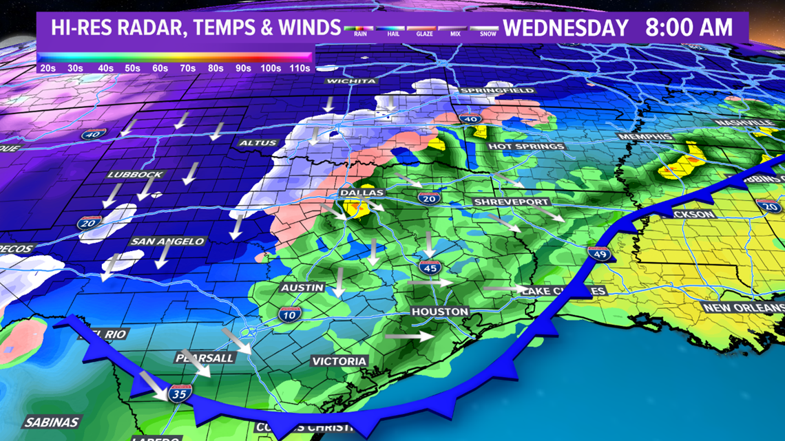
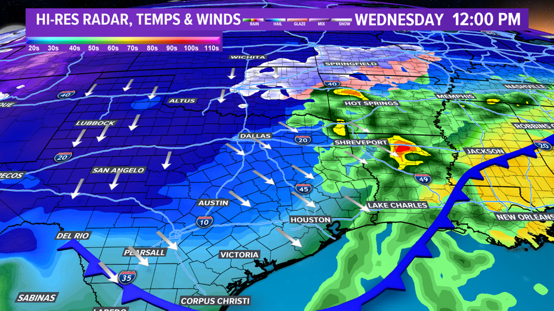
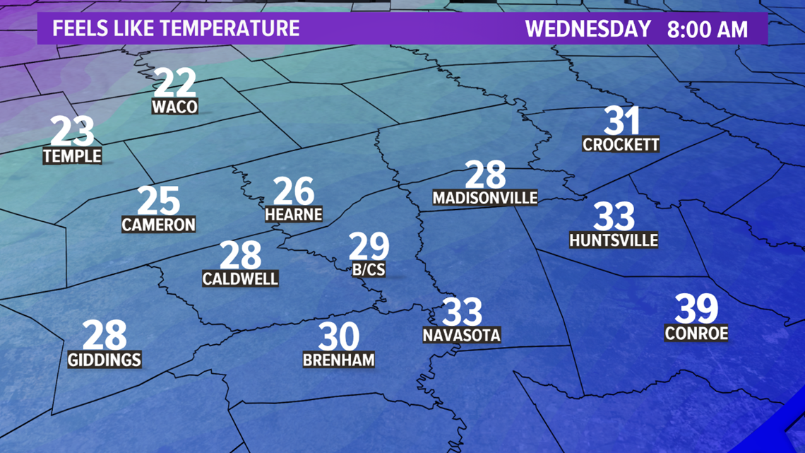
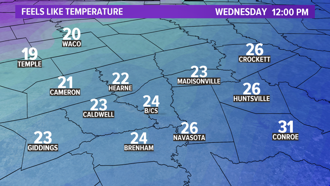
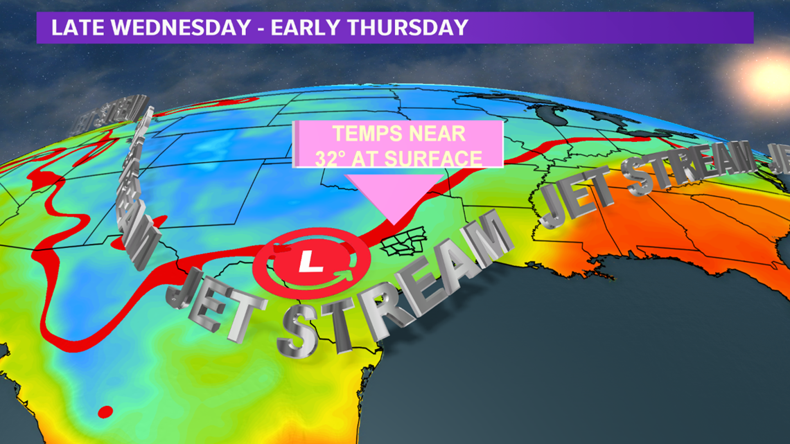
Temperatures & wind chills will continue to fall overnight Tuesday into Wednesday as the modified Arctic airmass filters in. At the same time, an potent upper-level system will be approaching from the west. This will aid in strong lift leading to widespread precipitation across Texas. In the Brazos Valley, temperatures will be too warm for a wintry mixture through the day on Wednesday. However, farther north, the freezing line moves through north Texas and should be located just north of Waco & Mexia by sunrise on Wednesday. The southern half of northern Texas will receive sleet & freezing rain while the northern half of northern Texas will see primarily snow. This wintry precipitation is expected to continue through Wednesday morning into the early afternoon hours.

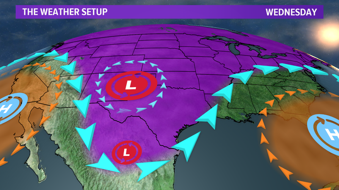


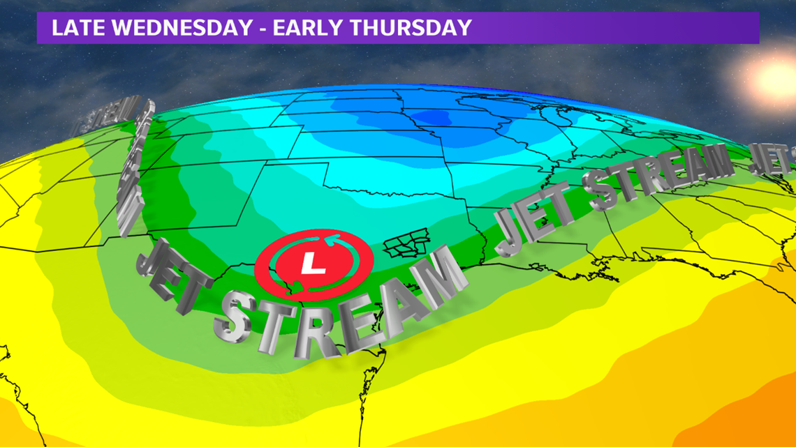
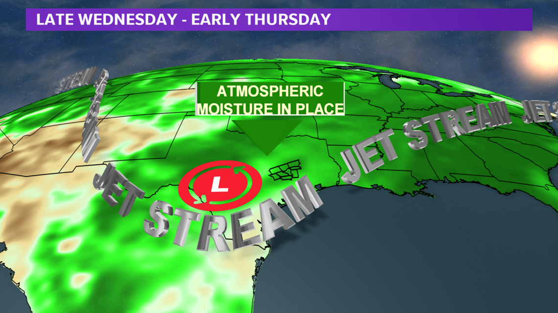
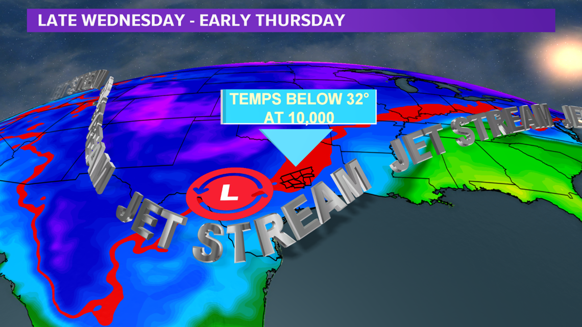
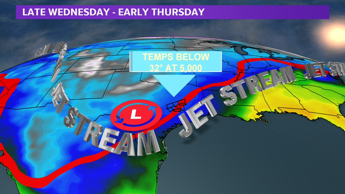
A secondary area of lift move over Texas Wednesday night into Thursday morning. This lift will try to squeeze any remaining moisture out of the atmosphere. At this point, temperatures will be significantly colder throughout the entire column of the atmosphere in the Brazos Valley. Temperatures from 10,000 feet to 5,000 feet will be below freezing and temperatures at the surface will be near freezing. This mean any precipitation that can develop will fall in the form of snow.


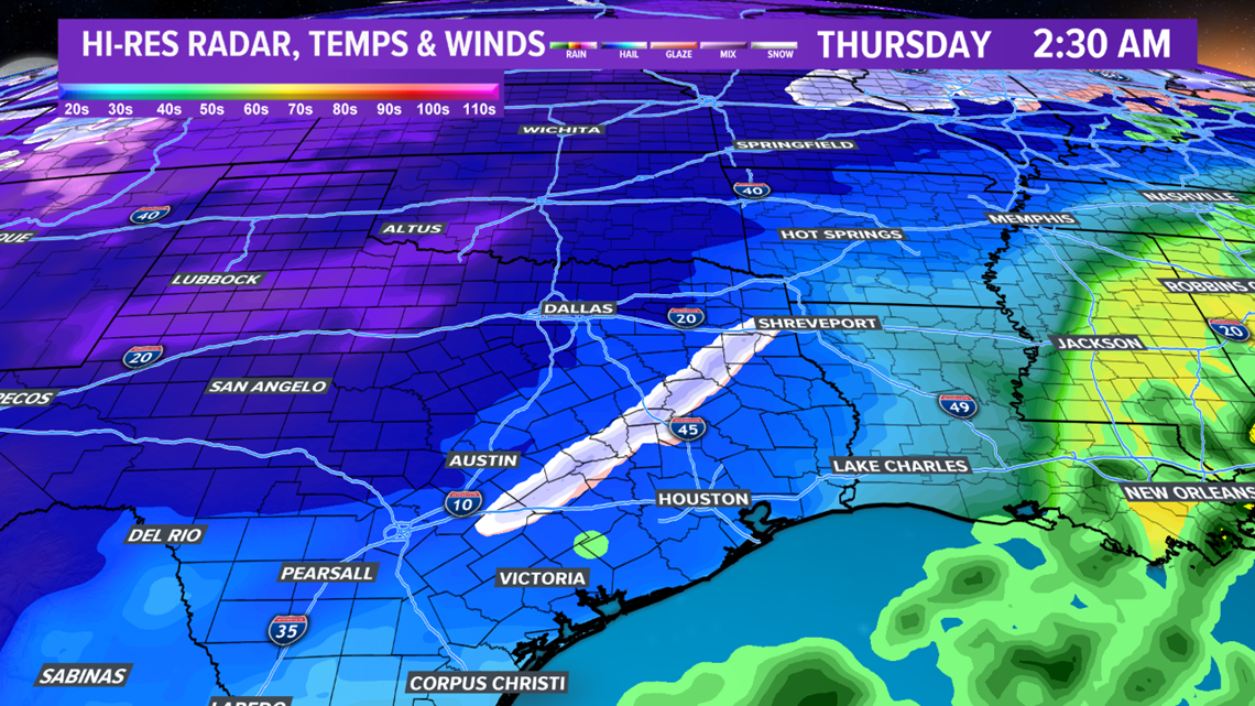

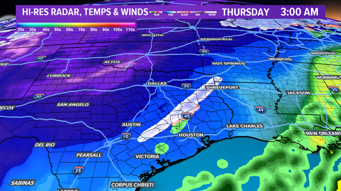

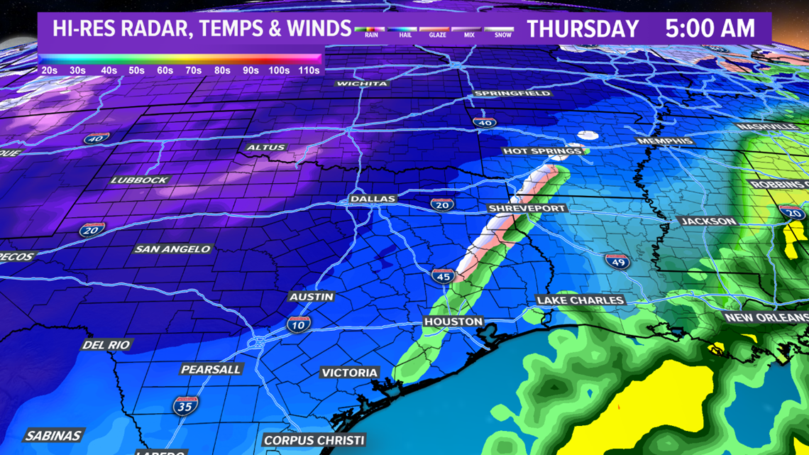
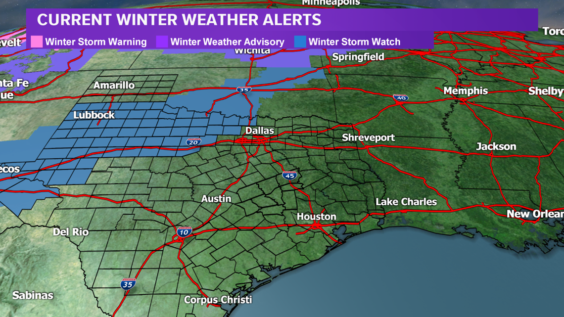
Accumulations for the Brazos Valley west into the Texas Hill Country look minimal to non-existent at this time. If more precipitation develops than expected, more snow mall fall and accumulate. This scenario will have to be monitored. Farther north, northern & western Texas and parts of Oklahoma will see several inches of snow. This will disrupt travel. A Winter Weather Watch is already in place for these areas.